The train arrives in Mary at around 2:00 in the morning, and we I pile off the train with a bunch of locals. It's quite cold, and at first I'm a little worried because no one exits through the station building, but from the ends of the platform. On the western edge of the station building is a small, semi-enclosed area full of vendors selling hot snacks, and I stop there to grab a fried pastry.
Thankfully, the station building was open, and there were lots of people milling about inside, presumably waiting for the next train. I find an empty bench and sit down and lean back to get some sleep, but a security guard approaches me. I figure he's going to tell me I can't sleep here (none of the locals seem to be asleep), but in reality he's just telling me to watch my stuff to make sure no one takes it. I'm a little surprised by his concern, but thankful.
It turns out that I could have taken an early-morning train to Bayram Ali, which is the town just south of the monuments at Merv, but since my plan was to exit to Iran via Serakhs the next day, I was planning on staying in Mary for the night, as it supposedly had a cheap hotel. A few hours later, when the sun was up, I set out to find the Hotel Caravanserai, which was described in the Lonely Planet. unfortunately, the map of Mary in the LP was almost as bad as not having a map at all, as it included streets that didn't exist, and pointed to the Hotel Caravanserai as being in the wrong location. I ended up wandering around some random streets until I ultimately got within a couple of blocks of where the hotel was supposed to be. When I though I was on the right street I asked some local shopkeepers where it was, but they hadn't even heard of it. Thankfully, a passerby heard my inquiries and told me they would take me there. It turned out to be on a small side street, less than 200 meters from the shops where I had been asking, but it had no sign on the outside and appeared to be just another house. Inside the compound, it was really arranged almost like a modern caravanserai, with rooms around around the perimeter of a courtyard (admittedly this is a pretty common layout in many places in the world).
I thanked the good Samaritan, and as I entered the hotel to try and find the receptionist or proprietor I was greeted by a couple of guys staying in one of the rooms by the entrance. They invited me to stay with them in their room, and they told me that I could stay with them for free. I later understood that this meant hiding me from the owner, and pretending that I wasn't there, which meant I had to sneak to the bathroom which was located further into the main courtyard. Well, that was fine with me. After dropping my stuff off and having a quick shower, I left to take a look around Mary and go to Merv.
How to get to the Hotel Caravanserai from the train station. There are reports that the hotel may be closed, but that may also just be local misinformation.
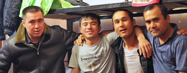 |
| The local workers (welders) who invited me to stay in their room in Mary. |
I didn't see too much of the town, but I found out from the bus station (just across from the train station) that there was a bus going to Bayram Ali at 11:45.
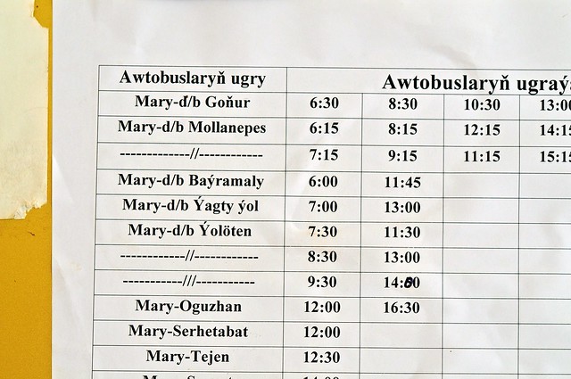 |
| Bus schedule from Mary. The 6:00 bus to Bayram Ali is convenient for those not staying in Mary (the local train at about the same time is probably even more convenient). Gonur is north of Bayram Ali, so those buses probably come close to Merv and may even pass near the entrance gate (but it's also possible they turn north before reaching Bayram Ali/Merv). |
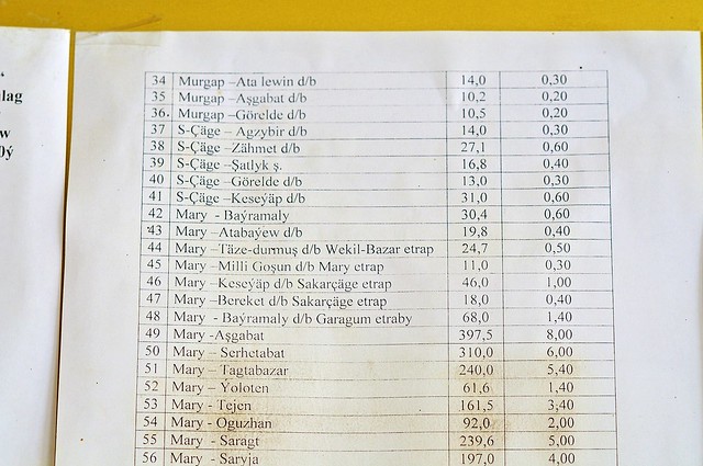 |
| Fare
sheet, showing the distance in kilometers followed by the fare in
manat. 400km to Ashgabat is 8 manat (same as the sleeper train), or
about $2.80. |
I hopped on the slow 11:45 bus and we dawdled our way east to Bayram Ali. As we got closer and closer, I was increasingly alert for any signs of old walls or any indication where I should get out. I eventually made the right call and got out just before the bus was about to make a turn into Bayram Ali, not far from the Abdullah Khan Kala (infuratingly, the LP map shows the edge of the Abdullah Khan Kala but doesn't show the adjacent roads which would illustrate just how close Bayram Ali is to the sites).
 |
| Once again the
Bradt map trumps the LP version (though it still doesn't show canals
that may impede or prevent progress). The bus from Mary turns right at
the corner by the bazaar, on the road headed to Turkmenabat, and that's
where you should get off. Taxis back to Mary leave from about where the
arrow to Mary is. |
Merv
Merv owes its existence to the Murghab River (a different Murghab River than the one we say near Murghab, Tajikistan), which brings water from the Afghan mountains and unceremoniously dumps it into the arid Karakum desert near Merv. Because the Karakum is flat, the Murghab River spreads itself into a wide delta here, and this fertile delta is what is responsible not only for Merv but for the even older Bronze-Age site of
Gonur Tepe to the north (possibly the birthplace of Zoroastrianism, the first monotheistic religion), as well as the modern cities of Bayram Ali and Mary.
However, because of the flatness of the desert, it's easy for delta channels to dry up and new channels be formed. These wandering channels led to wandering cities, as settlements would follow the water over time, with the result that instead of cities being rebuilt on top of each other, we have a succession of ancient cities being built next to each other. There are two such cities in Gonur Tepe, and five different cities in Merv.
One of these cities is the
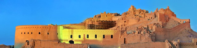
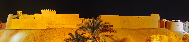
Abdulla Khan Kala, a Timurid city founded by one of Tamerlane's sons after the end of Mongol rule. Abdullah Khan Kala suffered from a lack of attention after the Timurid king decided on Samarkand as his capital. There's a moat surrounding the Abdullah Khan Kala, which is basically a huge square compound, of which nothing remains except the brick-faced rammed-earth walls: inside there is just a vast expanse of dirt and some hardy weeds, and maybe the odd goat or two. Even less remains of the the Bayram Ali Kala—the last of the five ancient cities of Merv and which was a western extension to the Abdullah Khan Kala—as apparently it was being used as a source of bricks when the Russians arrived in 1885.
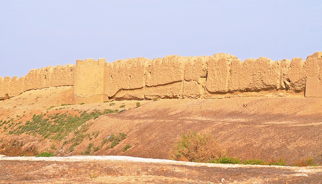 |
| The western walls of Abdullah Khan Kala, from near the Bayram Ali bazaar. |
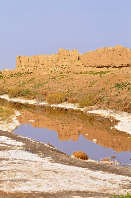 |
| Maybe "moat" is the wrong word. It's more like a ditch. |