Showing posts with label Penjikent. Show all posts

Monday, 22 October 2012

Padrud to to Dushanbe

Walking down the valley to Shing

I woke up early in the morning to be on the road by 6:00, which is supposedly when vehicles went down to Penjikent. After waiting by the main road in the darkness with Jumaboy for a while, it became fairly clear that whatever vehicles there were had already left, so I started to walk down the valley in the crisp morning air.

_DSC3075
By 6:45 the sun was up and I was on my way down the valley.

_DSC3076
Everything looks so different in the shade as opposed to the sun.

_DSC3078
Lake 3, with lake 2 behind it.

Saturday, 20 October 2012

Poverty and beauty in the Shing Valley

About Haftkul and the Shing Valley

The rugged Fann Mountains that line the southern side of the Zerafshan Valley are home to a number of gorgeous lakes, as well as lots of hiking opportunities. And although many of the lakes really require you to hike in and stay at Soviet-era Alpager camps, tent camps, and/or your own tent, the Haftkul (literally, "seven lakes")—also known as the Marguzor Lakes, after the largest of the seven lakes—in the Shing Valley are a relatively accessible way to dip your toes in the Fann Mountains. Buses to Shing (located below the seven lakes) run daily, as do share taxis to villages further up the valley. Because traffic is dominated by valley-dwellers who go down to the market in Panjikent in the mornings and return home in the afternoon, you can spend the morning in Penjikent (which is really all the time you need to see it) before going up into the mountains.

Making life even easier for the visitor is that there are a number of established ZTDA homestays in the valley, which assures you that you'll be able to find a place to stay. In all honesty, even if there weren't homestays you could probably find a place to stay in any village in the mountains, as locals will welcome you if you look like you need a place to stay (and probably even if you don't). Just be sure to offer them some money when you leave, and insist they take it (or pass it to a daughter if they really refuse), especially if they don't seem rich.

While I would have liked to have seen some of the more remote lakes, I was in the shoulder season and I didn't have a lot of time to extend my stay in the region (I wanted to be back in Dushanbe to pick up my Turkmen visa as soon as it was ready, as I had limited time on both my Tajik and Uzbek visas), so I decided to take things easy and head to the Shing Valley—while being open to crossing over to the next valley if it seemed reasonable. And to facilitate any hiking I might do, I arranged to leave my bag at the Elina Guesthouse and take only my camera bag and a change of clothes into the mountains with me.


Afternoon arrival & preliminary explorations

I ended up getting a share taxi from the lumber yard in Penjikent, and they were able to take me all the way to the uppermost ZTDA homestay settlement of Padrud. The Shing Valley starts just to the east of Penjikent, and as you head south up the valley the communities become smaller and smaller, and the road gives way to gravel and then becomes rougher and rougher.

The introduction to the seven lakes is a doozy, as the lowest of the seven lakes has an incredibly clear yet blue colour, and at the end of the lake you enter a series of rocky switchbacks as you pick your way up the rocky natural dams that separate the lakes. Although all of the lakes have been formed by rock dams, I'm not sure if these are the result of landslides (the highest dam in the world—the 567 meter high Usoi damn in the Tajik Pamirs—was formed by an earthquake in 1911) or as the result of glacial rock deposits known as moraines. I suspect moraines.

Those switchbacks are probably the most dramatic section of road in the entire valley, and they lead up to the second and third lakes, which are almost on the same level and are quite close to one another. After that, it's a couple of switchbacks up the the 1.6-km-long fourth lake, the southern end of which is where Nofin is located, and then up the valley towards Padrud, which is located on the rocky dam that forms the fifth lake.

On the way up to Padrud I discovered that one of the guys in the taxi ran the Padrud homestay, which was a bit lucky. We got dropped off outside the homestay, but the gate around the compound was locked, so he had to go retrieve a key from somewhere. In retrospect this is a bit weird, but I didn't think anything of it.

When we entered the house it was a bit weirder, as the table and living area was dirty, with peanut shells, crumbs, and candy wrappers on a greasy table next to the ZTDA folders and price lists, and the host did nothing to even try and tidy up or anything. Whatever. I was just interested in dropping off the change of clothes and toiletries I didn't want to carry with me, so I let the host know that I would like to also order dinner for that evening, and then I headed out to explore.

_DSC2126 (1) - _DSC2127 (1)
Padrud is built on the stony dam that gave rise to the fifth lake. Somewhat astoundingly, this little village is apparently home to 500 people.

_DSC2132
Walking up the hill toward the tiny fifth lake, Hurdak.

_DSC2130
Near the top of Padrud village.

_DSC2131
This freshly-washed carpet isn't likely to dry very quickly in this weather.

_DSC2133
Rickety little bridge near the outlet of the fifth lake.

_DSC2134
Circles of cow dung stuck against a rock to dry. I wonder how many trees the mountains could support in the absence of man. Probably quite a few. The lack of anthropogenic deforestation really makes the Rocky Mountains I'm used to look very different than these sorts of mountains.

_DSC2136
The road up from the fifth to the sixth lake.

_DSC2138
Looking down towards Padrud over the little dot of the fifth lake, surrounded by steep mountains.

Wednesday, 17 October 2012

Penjikent, where the journey is more interesting than the destination

As I said in my previous post, share taxis to points north of Dushanbe don't actually leave from the cement factory but from a kilometer or so north of there, where the buses that run along Rudaki turn around (the map below reflects this starting point, which you can see if you zoom in). When I eventually found my way there, I was quickly able to find jeeps going to Penjikent, and negotiated a seat for 90 somoni (almost as much as a seat from Osh to Bishkek, which is about three times longer). Transportation prices in Tajikistan are fairly high, in part because the roads are pretty bad, and in part because fuel is considerably more expensive than in Kyrgyzstan. (You're also more likely to have to bribe a policeman in Tajikistan, too.)


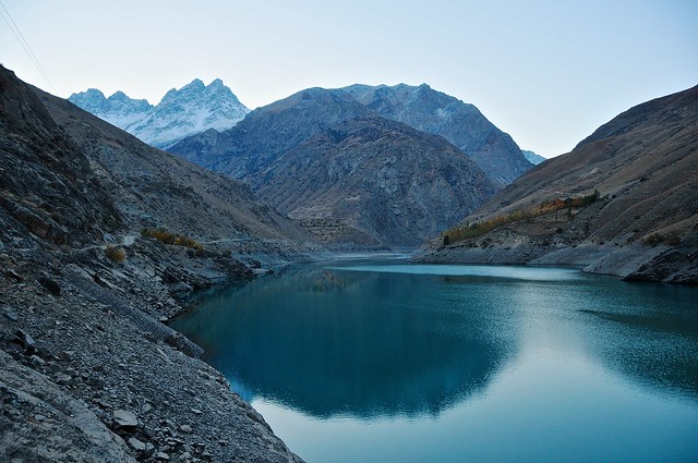
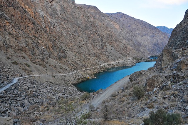
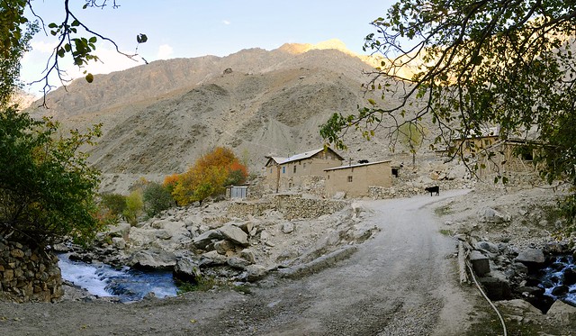
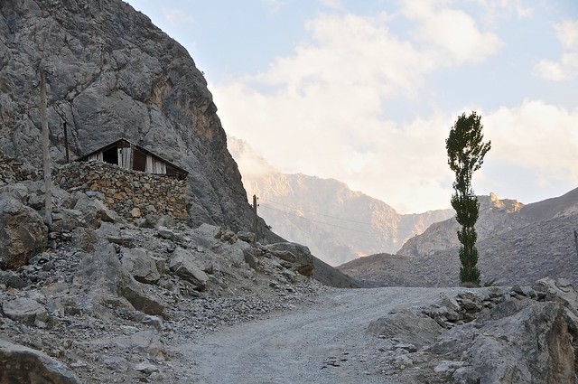
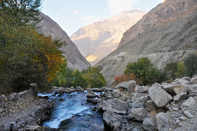
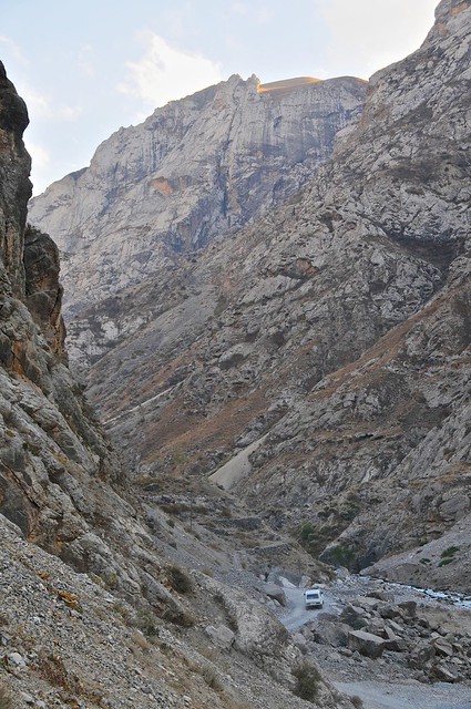
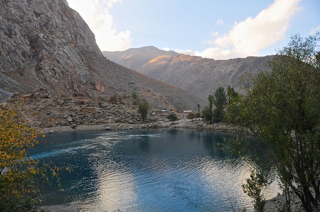
The first stretch of highway as you head north from Dushanbe runs through an increasingly rugged valley that is the backyard for Dushanbe's rich and powerful, who maintain palatial estates along the river. The town of Varzob is possibly the epicenter of ill-gotten wealth, and includes a Presidential retreat complete with imposing fences and security. After Varzob the valley becomes more steep and there are precious few opportunities to build mansions as the road hugs the hills as it wends its way through the Fann Mountains.

_DSC2015
The M34 somewhere past Varzob but before the Anzob tunnel.

_DSC2017
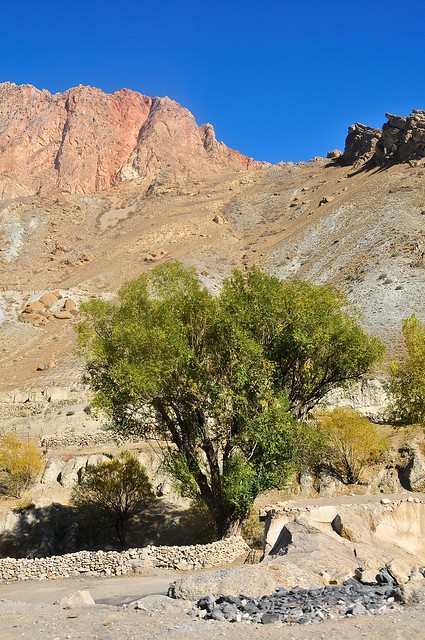
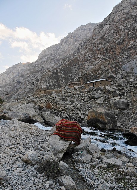
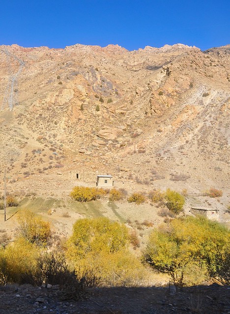
Though not particularly high, the Fann Mountains are rocky and support little vegetation. Or maybe it's more accurate to say that whatever vegetation that may have existed has been long since stripped by the peoples who have lived there.

The M34 between Dushanbe and Khojand is paved from start to finish, with the curious exception of the Iranian-built Anzob tunnel, also known as the tunnel of death. Officially opened in 2006, this 5-km-long tunnel bypasses the Anzob pass to the east, allowing the M34 to remain open—and northern Tajikistan connected to thre rest of the country—all year, regardless of the amount of snow in the Anzob pass. The problem is that this tunnel really isn't finished, as the surface inside the tunnel isn't paved, and is potholed and full of water year round as a result of spring-water that leaks into the tunnel from the ceiling. And despite the notoriety of the tunnel through Kyrgyzstan's Too-Ashuu pass, this tunnel is even more poorly ventilated, as there is only one fan in the middle of the tunnel, and its ineffectual whirling does little to clear exhaust fumes from the road. Supposedly the tunnel was to be completed in 2014, but I have difficulty believing that. (Edit: as of 2018 the tunnel is in good condition, with no potholes or water, and added ventilation, though apparently it can still get pretty polluted in there.)

There are also a number of smaller avalanche sheds along the road leading up to the tunnel, but these kinds of tunnels are much simpler since they are designed simply to protect the road from avalanches by allowing snow to wash over the roof. They're usually pretty short and just cover typical avalanche zones.

_DSC2021
After leaving the Anzob tunnel the road switchbacks and hairpins down and around the side of the the mountain.