We arrived in Murghab after dark, and were dropped off in front of the hospital, which has to be one of the bigger buildings in Murghab. We went with our Pamiri friend to greet his colleagues, who offered us some dinner, including meat that they later said was Marco Polo sheep. Dwindling populations of these animals make them something you would really rather not eat, but it's also difficult to fault people who live in such a harsh environment for hunting animals.
After eating we were shown to the room where Megi and I would stay: a simply room with six single beds. These Soviet-era beds had woven steel springs underneath the mattresses, and age and wear had resulted in them being like hammocks with a mattress on top. Traditional-style tapchans on the floor would have been preferable. Although the hospital was a solid building built in Russian/Soviet style, the bathroom facilities were rather shocking. There was a large outhouse building located a few dozen meter north of the hospital, with separate men's and women's sides. There wwas no electricity or lights, so we had to bring our own flashlights. Inside, these were the dirtiest and smelliest facilities I saw on my trip. Although everything was concrete, the holes in the floor were surrounded by toilet paper and shit where people had missed their target in the dark. It didn't seem like anything was ever cleaned. Apparently the women's side was even worse. Hardly the sort of hygiene one would hope for in a hospital.
The next morning we split up and arranged to meet later at the Yak House, which is a tourist-oriented handicraft shop on the northeastern edge of town. Since META had folded earlier that year (but has since resumed operation), it was the center of tourism in the region. I headed down to the mosque and market area, those being the only real places of note in town.
Since we were already at the edge of town with nothing more to explore in that direction (and not much to explore in Murghab), I suggested that we climb the mountains just to the north of the M41. Our Pamiri friend thought I was crazy, and said it would take at least four hours to reach the top. I figured we could do it in about an hour, but he said it was impossible and bet me I couldn't. I was surprised at how hostile he was to the idea of climbing, as he had earlier told us how he liked the outdoors and did things like weightlifting as a hobby. At any rate, he wasn't going to join us.
Back down in Murghab I went to the market to meet up with Megi, where we hoped to find a ride to Osh. Although she had originally planned on spending another day or so in the area, she decided to head up to Osh with me. For me it was important that we find a car leaving in the next day or so, as I only had two days remaining on my visa. There were only a few vehicles at the car park, and one of them turned out to be the Kyrgyz guy who had driven me from Osh to the Kyzyl-Art border! He was glad that I had managed to make it into the country, and it would have been nice to ride back to Osh with him since he was an honest guy, but he wasn't leaving for a couple of days. We managed to find another car that would probably be leaving the next morning, and we arranged to meet at the market taxi stand the next morning.
The next morning when we showed up, we rather predictably were still a couple of passengers short of a full load, so we had extra time to wander around the market and the marshy pasture south of the market. We managed to get another passenger, and then we all paid a bit extra to leave with only six passengers, and not the usual seven (170 somoni, as opposed to the usual 150 somoni—prices are comparatively low for this leg because drivers are able to use cheap Kyrgyz fuel instead of the significantly more expensive Tajik fuel). I managed to spend all of my Tajik somoni, and even had to use some of my Kyrgyz som to cover the supplement. I have had pretty good luck in using all of my currency as I leave the country, and rarely had to exchange extra currency after departing anywhere.
You see more of the traditional ak-kalpak felt hats in Murghab than anywhere in Kyrgyzstan. This isn't that surprising given the isolation of Murghab and the traditional Kyrgyz nomadic culture that exists there, unalloyed with any real urban or agricultural lifestyles. These hats came as a shock to Megi, however, as this was her first exposure to the Kyrgyz. She thought they looked ridiculous, and when I pulled my souvenir ak-kalpak out of my bag (bought for 200 som—about $4—in Osh) and put it on, she told me I had to take it off because she couldn't take me seriously.
After eating we were shown to the room where Megi and I would stay: a simply room with six single beds. These Soviet-era beds had woven steel springs underneath the mattresses, and age and wear had resulted in them being like hammocks with a mattress on top. Traditional-style tapchans on the floor would have been preferable. Although the hospital was a solid building built in Russian/Soviet style, the bathroom facilities were rather shocking. There was a large outhouse building located a few dozen meter north of the hospital, with separate men's and women's sides. There wwas no electricity or lights, so we had to bring our own flashlights. Inside, these were the dirtiest and smelliest facilities I saw on my trip. Although everything was concrete, the holes in the floor were surrounded by toilet paper and shit where people had missed their target in the dark. It didn't seem like anything was ever cleaned. Apparently the women's side was even worse. Hardly the sort of hygiene one would hope for in a hospital.
The next morning we split up and arranged to meet later at the Yak House, which is a tourist-oriented handicraft shop on the northeastern edge of town. Since META had folded earlier that year (but has since resumed operation), it was the center of tourism in the region. I headed down to the mosque and market area, those being the only real places of note in town.
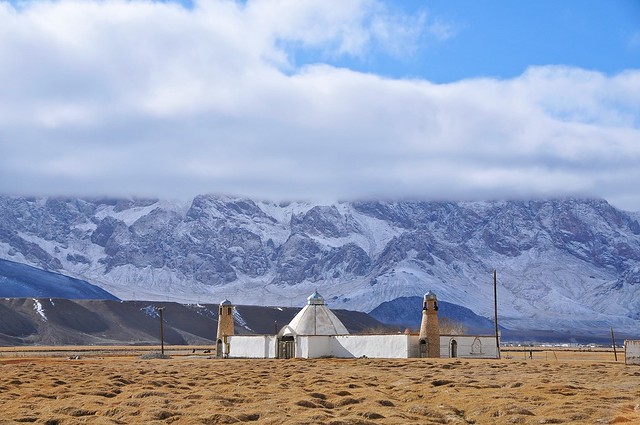 |
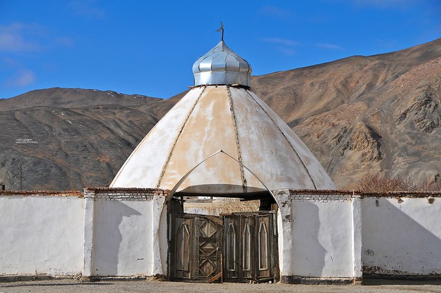
| The Murghab mosque. Most of the high Pamirs east of the Koi-Tezek pass is ethnically Kyrgyz and therefore Sunni, for whom mosques are of relatively greater importance. |
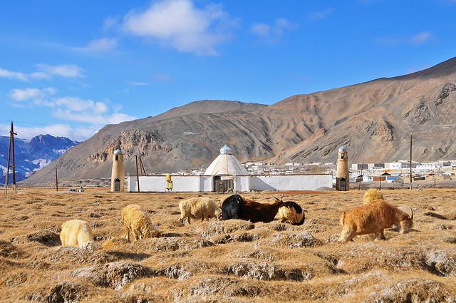 |
| Goats in the bumpy marshland in front of the mosque. |
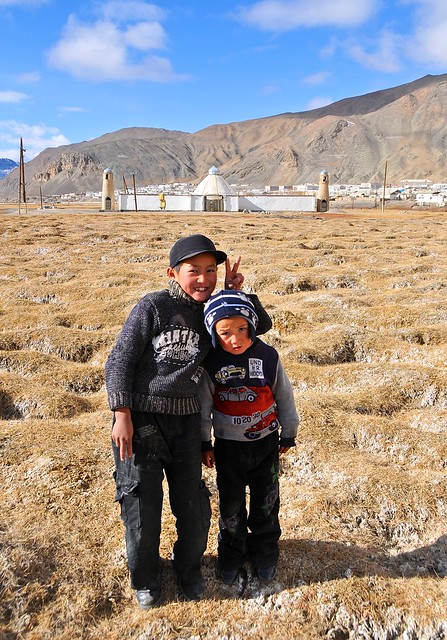 |
| A pair of kids were near the goats, though not exactly shepherding them. |
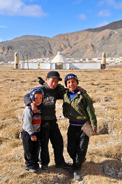 |
| A foreigner with a camera? Let me get in on this action! |
 |
| The Aga Khan doesn't limit his aid to Ismailis, but helps the greater community (including the water pipeline I saw in Kyrgyzstan near Sary Tash). On the mountain to the left of the dome you can see a message of welcome to the Aga Khan spelt out in stones. |
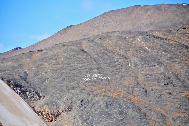 |
| The Aga Khan is also known as the Mawlana Hazar Imam, so I believe this is supposed to read "Welcome our Hazar Imam." |
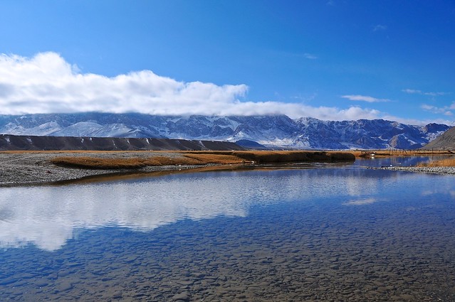 |
| A river and backwater eddies are south of the mosque. |
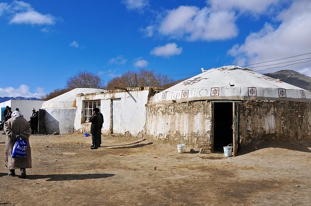 |
| A brick and mortar yurt anchors one end of the market. Meat is sold inside. But what I really want to talk about in this picture is the blue plastic bag that old lady is carrying. It caries the logo of the "Aygen Collection," and it's the unofficial bag of Kyrgyzstan and Tajikistan. But although it looks like the bag of some sort of designer label or store—albeit one unintelligible to those who use it—it actually corresponds to no label or store known to Google. Instead, the label really describes the bag, and it's popular because it's a a relatively strong and reusable bag. You do have to pay for them, but they're everywhere. Apparently in the mid-90s the bag of choice in the region bore the logo of a Glascow pet store. |
 |
| The ubiquitous bag photo-bombs an editorial photo illustrating drinks vendors in Kyrgyzstan. |
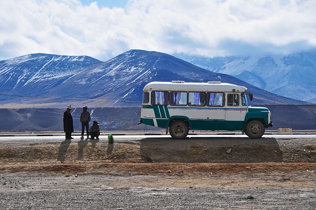 |
| A real, authentic bus. I guess they do have bus service between Murghab and (presumably) Khorog on occasion. |
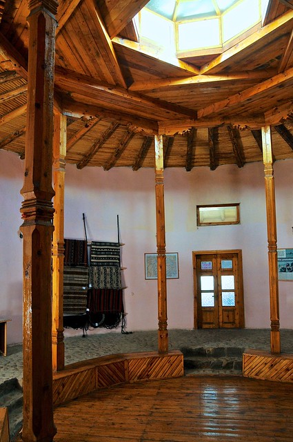 |
| When I was there META had stopped operating, though they have since resumed operations. This was in the Yak House, which is an attractive and new circular building on the northeast edge of town. They have some information and sell locally-produced handicrafts with fixed prices (they do something similar in Khorog's Central Park). In this picture you can see a traditional Pamiri skylight, with four concentric squares representing the four elements. |
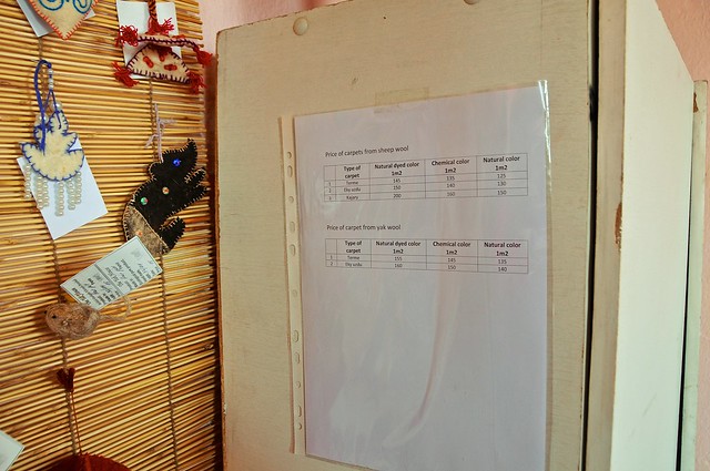 |
| Price list for carpets, per square meter, based on the type of carpet as well as the fiber and dye used. |
 |
| Yak house is just at the edge of town. |
Since we were already at the edge of town with nothing more to explore in that direction (and not much to explore in Murghab), I suggested that we climb the mountains just to the north of the M41. Our Pamiri friend thought I was crazy, and said it would take at least four hours to reach the top. I figured we could do it in about an hour, but he said it was impossible and bet me I couldn't. I was surprised at how hostile he was to the idea of climbing, as he had earlier told us how he liked the outdoors and did things like weightlifting as a hobby. At any rate, he wasn't going to join us.
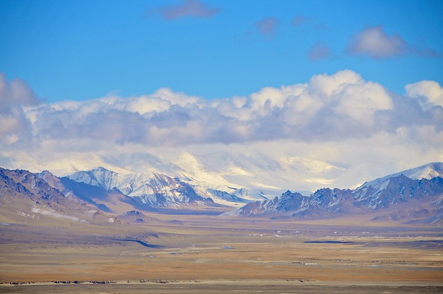 |
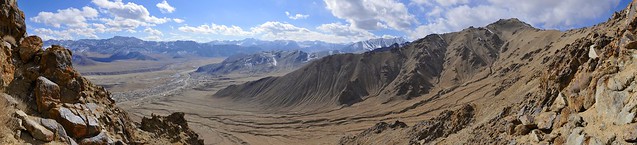
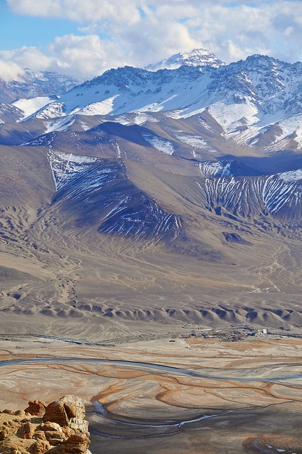
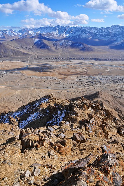
| Our route was to climb the nearest ridge to the highway, then follow it up to the summit. This meant pretty steep climbing in the beginning, but it meant we were quickly rewarded with great views. This is looking east, and the at the end of this valley, over 100km away, you can see the 7,000 meter Muztagh Aga in China. |
 |
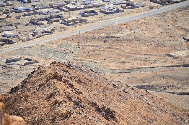
| Partially up the ridge , looking down over Murghab. |
 |
| The scramble up to this point was pretty steep, and Megi wasn't feeling so good and didn't feel like she could continue so she stopped and rested here while I continued. |
 |
| Pushing up past a sub peak on the way to the top. |
 |
| It would have been easier to walk up the relatively gentle slopes of the valley instead of heading for a ridge. |
 |
| Megi is a litle orange speck above the M41 and Murghab. |
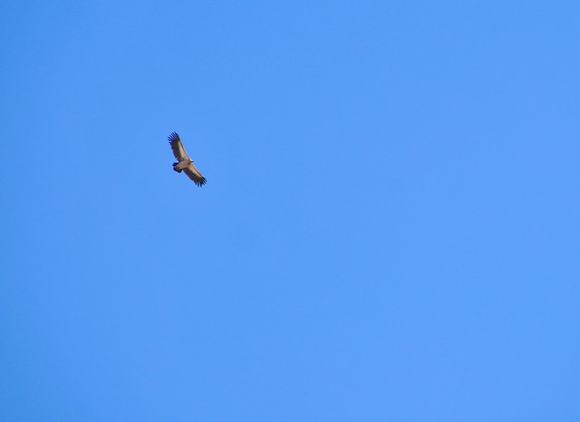 |
| The first vulture since Langmusi, a couple of months earlier. |
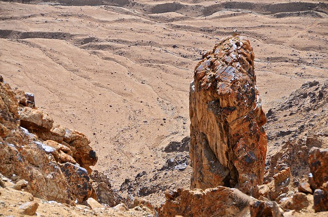 |
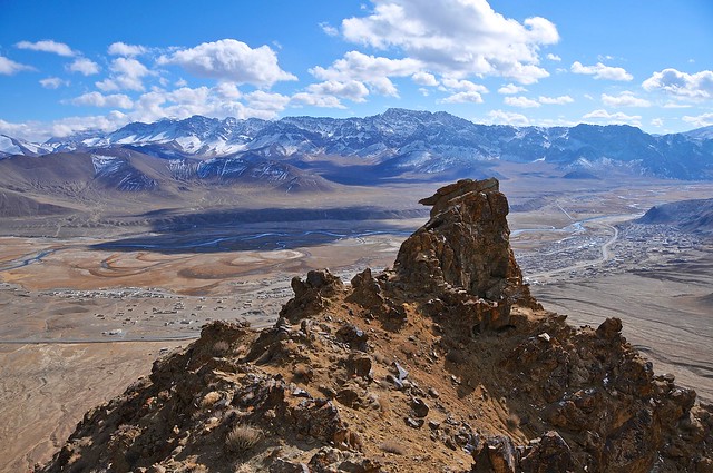
| Rocky outcroppings. |
 |
| Looking south over the Murghab river. |
 |
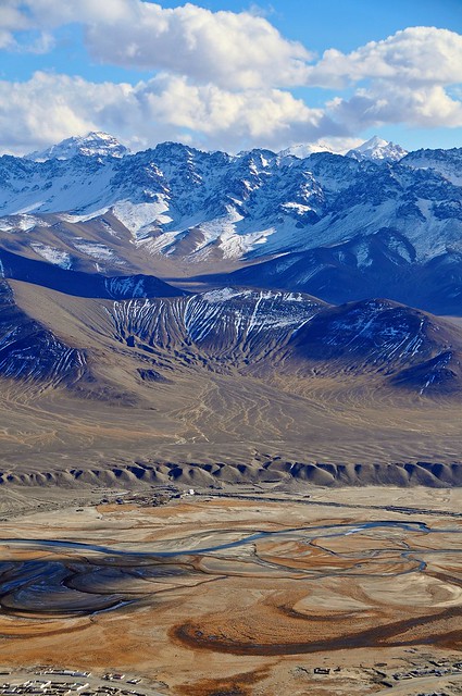
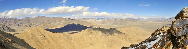
| Looking north from the top, over colourful mountains. You can see the M41 running through the valley on the right. |
 |
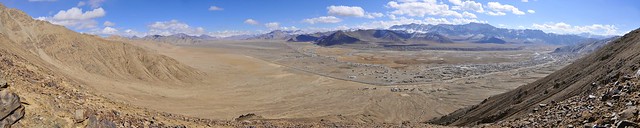
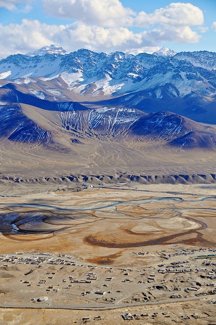
| Murghab and the M41 running towards Khorog. |
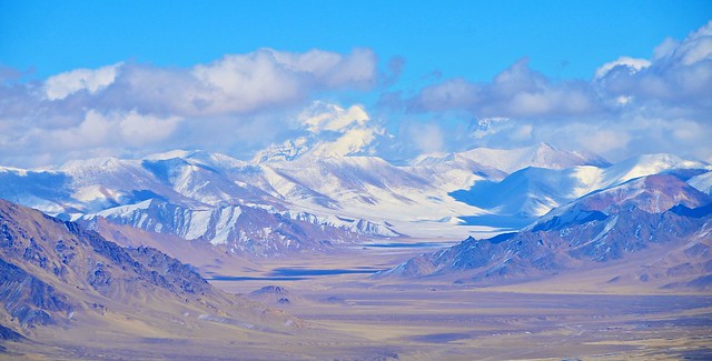 |
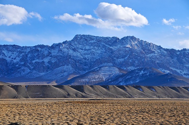
| The clouds have cleared to the eats, affording better views of Muztagh Aga. There is a road to China that heads off in that direction, and is used by the Chinese trucks that pass through Murghab and Khorog, but the border at the Qolma pass is only open to Chinese and Tajiks... otherwise it would be a great way to pass from the Chinese Pamir into the Tajik Pamir. |
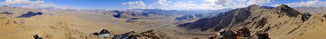 |
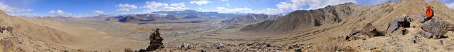
| Panorama looking south. |
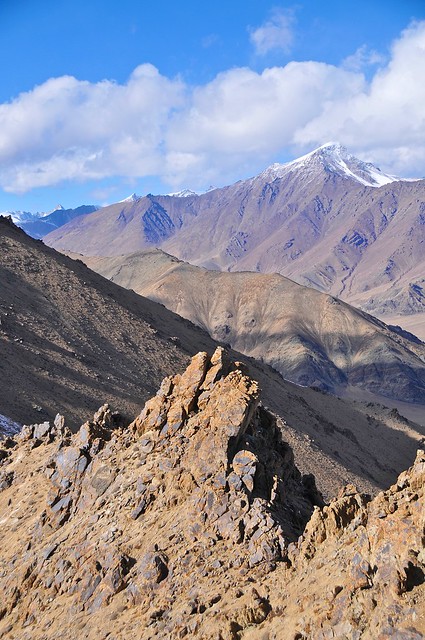 |
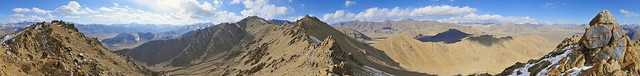
| Looking northwest along the summit ridge. |
 |
| The valley must be green and lush in the summer, but always ringed by harshness. |
 |
| Certainly the town of Murghab is much more depressing than Tashkurgan, which is one of the admitted benefits of China's sinacization of its territories. |
 |
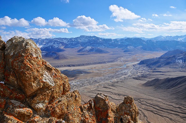
| Looking down the ridge over Murghab and the mountains to the south. |
 |
| Looking north, with the M41 clearly visible on the center right. |
 |
| The summit I reached was at 4,380 meters—some 750m above Murghab's 3,630m elevation. Probably the highest I had ever been, but we would surpass that the next day at the Akbaytal Pass on the M41. It admittedly took well over an hour to get here, but it was very doable and took less than half the time our friend estimated. |
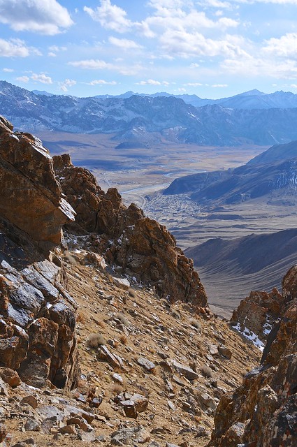 |
| The scramble down from the peak was rather difficult, as the stones were more like boulders, and it was difficult to get good footholds on the steep slope. |
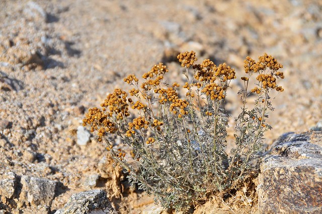 |
| Down in the valley, some desicated flowers. |
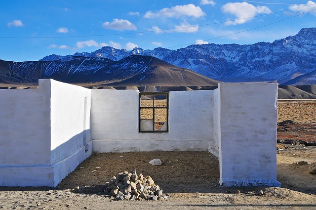 |
| The shell of a building. I'm not sure I understand the design, with walls on only three sides. |
 | ||
| I really wonder what this is like in the summer. It looks so harsh and inhospitable now, but it's also only about 150km from Tashkurgan, which was green and gorgeous in late August (although Tashkurgan is at about 3,060m, while Murghab is at about 3,630m). |
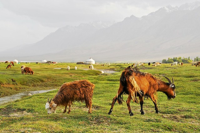 |
| For comparison, this was in Tashkurgan about 70 days earlier. Similar terrain (marshy mounds by seasonal rivers, in a broad valley fringed by relatively low mountains), and both sport a Kyrgyz population, but I wonder if they look the same in summer. |
Back down in Murghab I went to the market to meet up with Megi, where we hoped to find a ride to Osh. Although she had originally planned on spending another day or so in the area, she decided to head up to Osh with me. For me it was important that we find a car leaving in the next day or so, as I only had two days remaining on my visa. There were only a few vehicles at the car park, and one of them turned out to be the Kyrgyz guy who had driven me from Osh to the Kyzyl-Art border! He was glad that I had managed to make it into the country, and it would have been nice to ride back to Osh with him since he was an honest guy, but he wasn't leaving for a couple of days. We managed to find another car that would probably be leaving the next morning, and we arranged to meet at the market taxi stand the next morning.
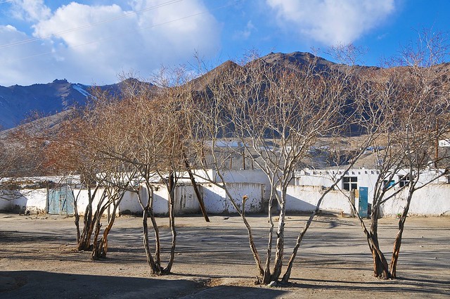 |
| I believe these trees at the east end of the market might be the only trees in Murghab. |
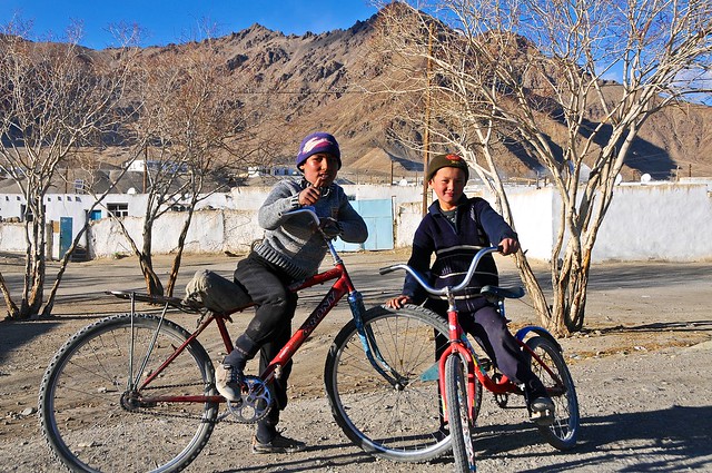 |
| A couple of kids on bikes show up to say hello. |
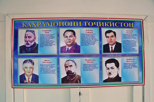 |
| This sign inside the hospital displays political leaders. President Rahmon on the top left, just above Tajik Hitler. |
The next morning when we showed up, we rather predictably were still a couple of passengers short of a full load, so we had extra time to wander around the market and the marshy pasture south of the market. We managed to get another passenger, and then we all paid a bit extra to leave with only six passengers, and not the usual seven (170 somoni, as opposed to the usual 150 somoni—prices are comparatively low for this leg because drivers are able to use cheap Kyrgyz fuel instead of the significantly more expensive Tajik fuel). I managed to spend all of my Tajik somoni, and even had to use some of my Kyrgyz som to cover the supplement. I have had pretty good luck in using all of my currency as I leave the country, and rarely had to exchange extra currency after departing anywhere.
 |
| Looking west towards China and Muztagh Aga. |
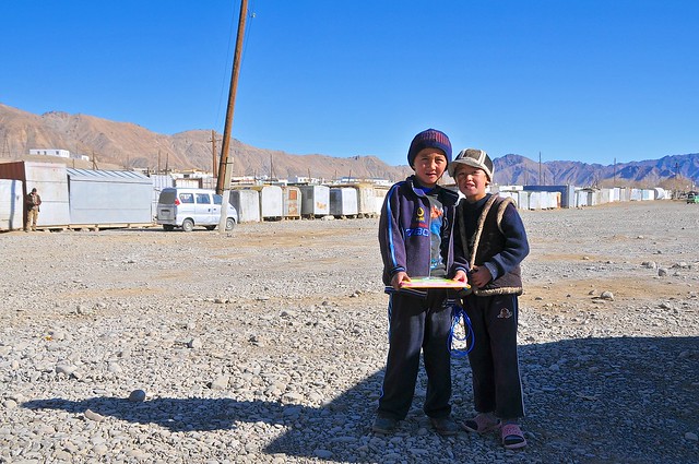 |
| Two kids in the parking lot in front of the market, where share taxis are arranged. You can see the containers lined up in the background: their entrances face the market and comprise most of the shops. |
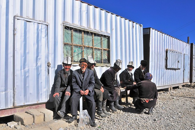 |
| Kyrgyz men in their characteristic ak-kalpak hats outside a shop. |
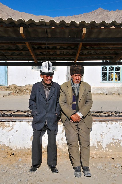 |
| The guy on the left insisted I take their picture, but the guy on the right wasn't so keen on it. |
You see more of the traditional ak-kalpak felt hats in Murghab than anywhere in Kyrgyzstan. This isn't that surprising given the isolation of Murghab and the traditional Kyrgyz nomadic culture that exists there, unalloyed with any real urban or agricultural lifestyles. These hats came as a shock to Megi, however, as this was her first exposure to the Kyrgyz. She thought they looked ridiculous, and when I pulled my souvenir ak-kalpak out of my bag (bought for 200 som—about $4—in Osh) and put it on, she told me I had to take it off because she couldn't take me seriously.
Budget
October 29, Murghab: 12 somoni- Fig cookies and soup: 12 somoni
Hi there,
ReplyDeleteWe will be driving the Pamir Highway and through Wakhan Corridor in August, and filming for a documentary. We love your blog and have learnt so much from it - I am wondering if you could advise on one area. Would you recommend that we get a satellite phone? Or is there adequate network coverage? If so, what network? We are two women, driving this ourselves, so would like to have enough signal to make a phone call at any point along the route should we get into trouble.
If you have any other tips, please let us know. I wasn't able to find an email address for you.
And to check out our documentary plans, visit:https://www.facebook.com/womenbehindthewheel2018/
Thanks!
Catherine
Our email address is Catandhan@yahoo.com if that's easiest for you to respond to!
ReplyDeleteThanks again