My earlier decision to sleep at the Taj Mahal but use the nearby Osh Guesthouse for
information was a good one, as the Taj Mahal is much quieter and allows for better sleep. After waking up refreshed I stopped by the Osh Guesthouse in the morning to see if
they had received my boots. Boots? Yes, boots. You see, my Blundstone boots had developed a rip in the leather where it joins the sole— a chronic problem, as this was the second pair to develop the same problem, and I already had the first pair replaced in the US under warranty.
Blundstone: horrible US warranty service, amazing Australian warranty service
Getting warranty service on the first pair was not easy, as I didn't have the receipt and didn't live close to where I bought them. I contacted Blundstone's US distributor, but they never returned my emails. I finally resorted to contacting Blundstone Australia directly, and after sending them a couple of pictures showing the problem, they airmailed a pair of replacement boots from Australia! That's pretty amazing, even if their US distributor is crap.
So when my replacement pair developed the same problem in Mongolia, I was pretty disappointed, especially since it meant my right foot would now get wet in shallow puddles (Blundstones are waterproof for brief periods, and walking through ankle-deep water usually isn't a big problem). Given my prior experience with Blundstone Australia, I figured they would help me out, but being on the road I didn't really have a good place to get them sent. But when i went through Osh the first time, knowing that I would be back there in a few weeks on my way to Tajikistan, I asked at the Osh Guesthouse if they had an address I could get stuff sent to (and how safe it would be to do so). They said it should be pretty safe, as they would just get a note in the mail telling them to come pick something up, but that it could take a while to get there. I asked Blundstone Australia if they could send out a replacement to the Osh Guesthouse, and they readily agreed to.
GBAO permit through the Osh Guesthouse
I had hoped that the boots would have arrived safely by the time I got back to Osh, but they weren't there. While talking to the guys at the guesthouse, however, and talking about the problems of getting a GBAO permit and inquiring as to whether the pamirs were really open for tourists, I was told that not only were the pamirs open and permits being issued, but that I could get a permit from them at the guesthouse. It would take a few days processing and $40, but it was possible. This was great news for me, as it would mean I could take the direct route from Osh to Murghab, instead of first heading to Dushanbe and backtracking to the pamirs and coming back to Osh on my way out of Tajikistan.
I applied for the GBAO permit and decided to spend the processing time in the villages of Sary Mogol and Sary Tash in the Alay Valley near the Tajik border. This was the same valley I had driven through as I entered from China, and from Sary Mogol you apparently have great views of
Pik Lenin, a 7,000+ meter peak on the Tajik border.
Osh's CBT office: not helpful
I went to the Alay Hotel, where the regional CBT office is located, to see what sort of options CBT had in the region and to see if I could reserve a spot in the Sary Mogol CBT homestay that night. The CBT office was really quite unhelpful, telling me that they wouldn't call the Sary Mogol homestay and that I could simply arrive and find the home-stay quite easily as everyone knew where it was. It's easy to see why the system isn't working as well as it could, as I described in my Arslanbob post. I suspect that if I wanted a service for which I would have directly paid the guy at the office he would have been more helpful.
I went down to the marshrutka and taxi stations near the market to see if I could get a ride to Sary Mogol, and ended up finding a ride in what Lonely Planet calls the Agromak 4WD stand (which is really just a big parking lot behind some street-front blocks, and most of the vehicles are not 4-wheel-drive. I ended up grossly overpaying, as I apparently agreed to pay 700 som for a ride to Sary Mogol, which Lonely Planet says is twice what I should have paid (though I think their prices for the Osh-Sary Tash route are too low). It seemed reasonable in light of the 1,000 I paid from Irkeshtam, but
c'est la vie. I hate haggling, especially since it seems entirely haphazard whether the driver initially quotes you a fair price or a wildly-inflated price.
The M41 between Osh and Sary Tash
The ride up to Sary Tash would be the first time I had done this stretch of the M41 during the day, and it was really quite impressive. The first half hour or so from Osh is relatively flat farmland that is part of the Ferghana valley, but it eventually starts to climb into a mountain valley, culminating in the 2,391 meter Chiyrchyk Pass, some 80 km from Osh. After that pass you drop down into the town of Gulcha (1,546 m) and up the Kurshab valley. Whereas the mountains before the Chiyrchyk pass were grassy and green, the mountains in the Kurshab valley are red and craggy, with a wide and stony riverbed that looks tame and narrow in the fall but must appear very different during the spring melt.
At a couple of places along the road, where the valley was narrower and the highway had more bends, I saw wrecked tractor-trailers. For the most part they had failed to negotiate a corner and had gone straight off the road. I had a difficult time imagining that the government really cares that much about removing wrecked trucks from the sides of roads, so I imagined that they had been there for some time. I was wrong about this, however, as when I returned to Osh a few days later they were gone (maybe they are valuable as scrap?). I suspect that these crashes may have been fatal, as nobody in Central Asia likes to wear a seatbelt, and drivers (and front-seat passengers) only pretend to wear them by slinging them across their bodies when they pass police checkpoint. In fact, wearing your seat belt is likely to be taken as an insult by your driver, who will proceed to tell you how good a driver he is. Such a good driver that not even the argument that you are protecting yourself from the other bad drivers on the road will be satisfactory: he's so good he can avoid those bad drivers.
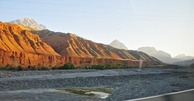 |
| The Kurshab riverbed and mountains after Gulcha. |
 |
| The lower mountains are surprisingly grassy. |
 |
| Red mountains by the river, grey stone up above. |
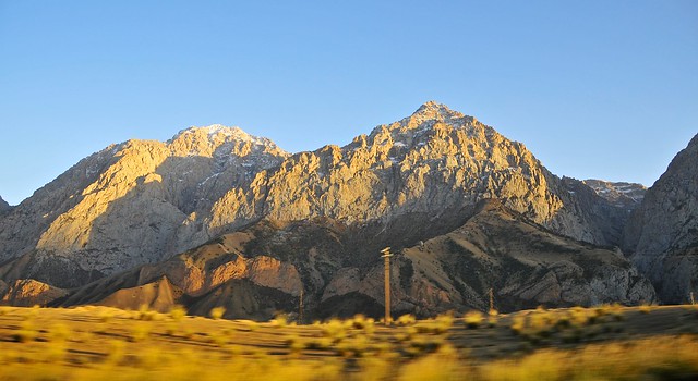 |
| The further up the valley you go, the less red and more grey the mountains become. |
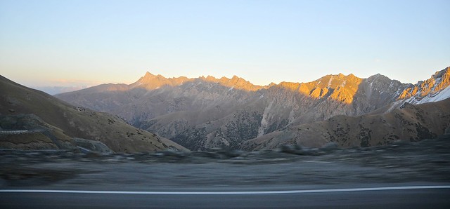 |
| At the end of the Kurshab valley is a series of switchbacks making the 600 meter climb to the 3,583 meter Taldyk pass. This is from the summit, looking east at the peaks that ring the terminus of the Kurshab valley. From here it's a gentle 12 km descent to Sary Tash, at 3,166 meters. |
Sary Mogol
Sary Mogol is about 35 km west of Sary Tash on the road leading to the Tajik border at Karamyk. (The Chinese border at Irkeshtam is 70 km in the opposite direction from Sary Tash.)
The sun had set by the time we arrived in Sary Mogol, and I spent some time looking for the CBT homestay. There certainly weren't any signs pointing the way, and the few people who were about didn't seem to know what I was talking about. While wandering around, I ran into one of the men who had also been in the van from Osh, and since he could tell I was having trouble finding a place to stay he invited me to stay at his house. I readily accepted, not least because it was already quite cold.
His house was modest, and his family large, but they received me with the warm hospitality that seems to be a hallmark of communities where life is harsh (and Muslim communities in particular). Once again, my camera was a good icebreaker—especially with his kids—and my Silk Road guidebook also served as a basis for communication (not so much the language section, but in terms of looking at maps and pictures).
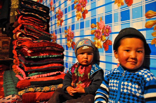 |
| Two of his son, in front of a thick stack of futon-like kurpacha mattresses and blankets. He had four sons and two daughters. |
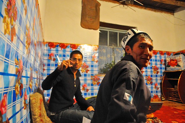 |
| The father and me, as I demonstrate how to take a picture: full press, not a half press. |
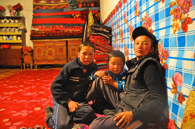 |
| The three oldest sons. |
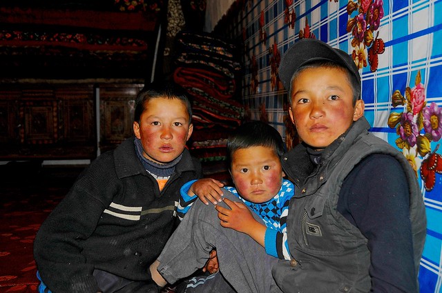 |
| With the harsh light of the flash you can see just how sun- and wind-burnt their cheeks are. This is a common sight on the jailoo, as well as in Mongolian herders. |
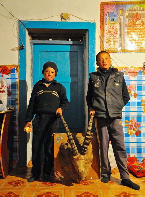 |
| Posing with a Ibex trophy. |
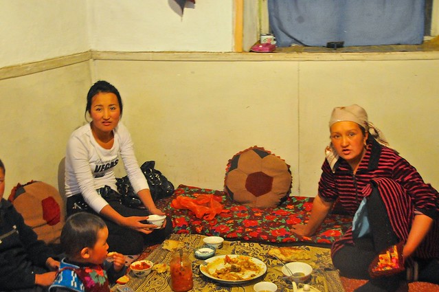 |
| One of the sons took the camera into another room, where the eldest daughter and the mother ate. She's wearing a miniskirt and leggings. |
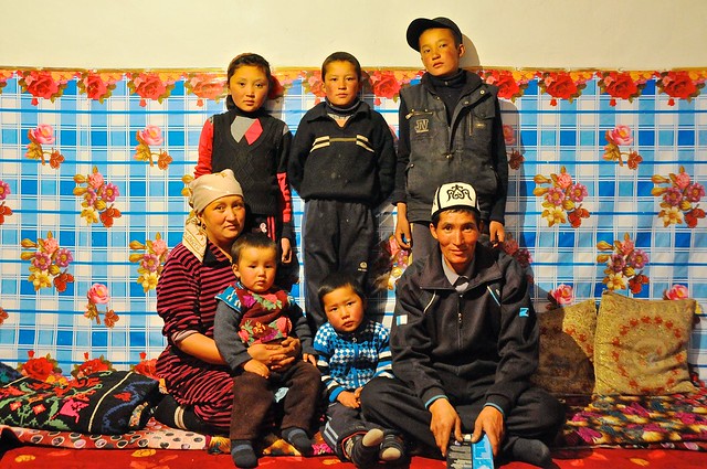 |
| Family portrait. |
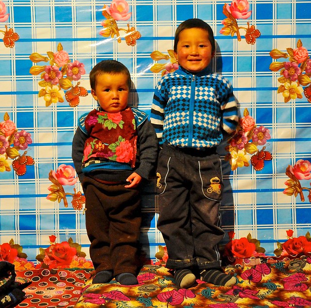 |
| The youngsters. |
Dinner was simple, with bread, tea, some tomatoes, and some meat and potatoes. I shared some fruit I had bought in Osh: apples and pomegranate. There was a basin next to the entrance in which one could wash your hands with water from a pitcher, and an outhouse at the edge of the yard. Apparently there is a village banya where one can bathe properly, but I suspect this is a luxury that is enjoyed rather infrequently.
I slept in the room next to the older sons, and in the morning we enjoyed a typical breakfast of tea and bread, and I left my jar of black currant jam with them. The second-youngest son showed me the family goats that were in the adjacent pen.
 |
| Family goats. |
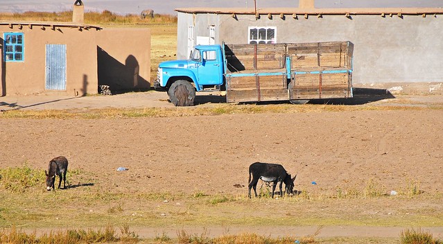 |
| It's interesting to see what the kids take pictures of, and what they think is interesting. |
 |
| The house entrance. |
I left my bag on the porch outside their house so I could pick it up later. The father was already gone by the time I was up and about, which in some ways was a good thing, as it helped avoid what could have been an awkward transaction. This was a really poor family, and although they didn't host me in the expectation of any payment, it would have felt wrong not to pay them. Of course, given local values on hospitality, this can come across as insulting or demeaning, and it's difficult to know just how hard you should press (they may feel compelled to refuse a few times, even if they are willing to accept—something which is virtually ritualized in Iran, with the practice of
t'aarof). Because I wanted to pay something and make sure it wasn't refused, I stopped the eldest daughter as she was one her way out and gave her 200 som. She can't really be blamed for not refusing, and by giving it to a daughter there's probably a better chance that it goes straight to her parents (not that I think the boys were less honest, just that they're probably more prone to temptation, especially given their age). Hospitality is great, and almost always sincere and without ulterior motives, but it's difficult to justify consuming scarce resources from poor families without compensating them.
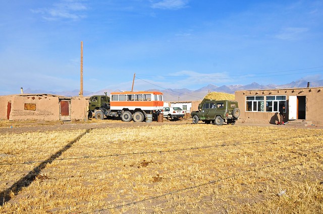 |
| An interesting people-mover: I suspect it's probably used in taking tourists to the nearby base camp for Pik Lenin. |
 |
| Looking south through the village towards the Trans-Alay range and Pik lenin. |
 |
| Local kids on an oversize bike. |
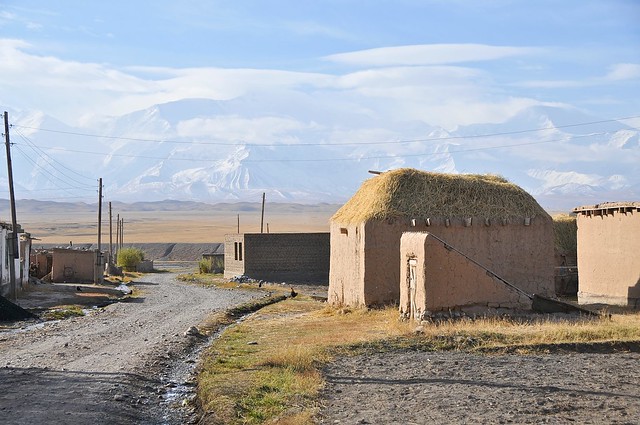 |
| Hardly looks like a 7,000+ meter mountain. |
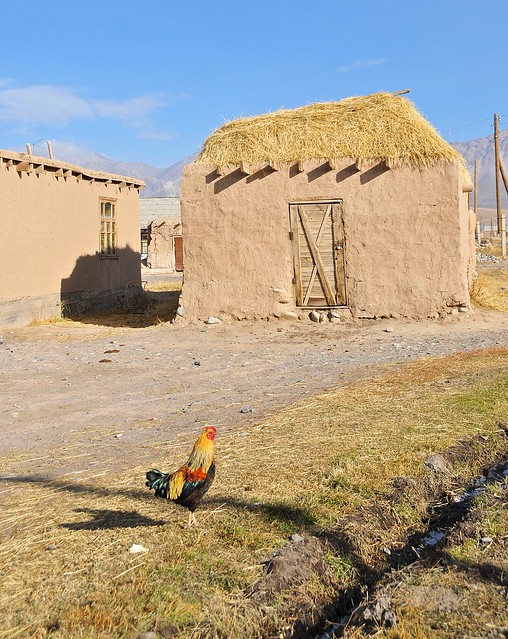 |
| Colourful rooster in front of a hay-piled storehouse. |
 |
| A weirdly robus concrete wall at the south end of the village. I wonder what the Soviets used it for? |
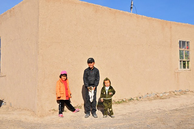 |
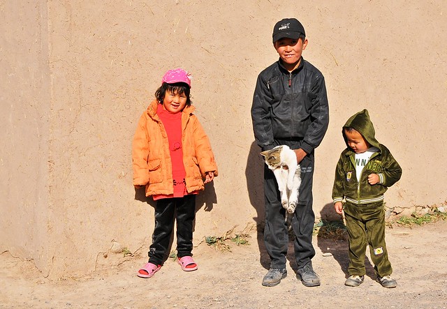
| These kids dragooned a reluctant cat into posing with them. |
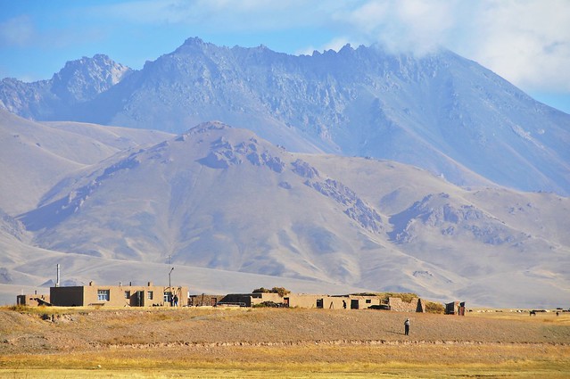 |
| Looking north at the edge of the village. Those mountains in the back are around 4,000 meters high—maybe 600 meters higher than the valley. |
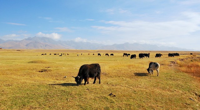 |
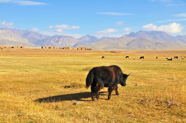
| Yaks graze just south of the village. |
 |
| Going by the pictures alone, it's easy to forget you're at 3,000+ meters and that the night was so cold that there was fresh ice on the river that morning. |
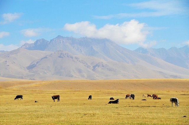 |
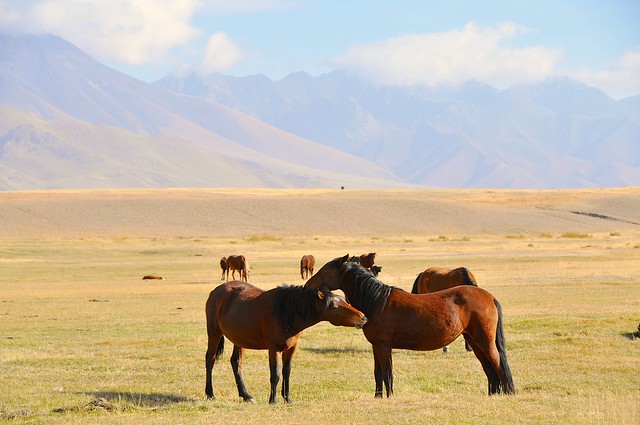
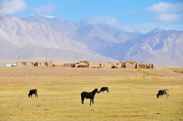
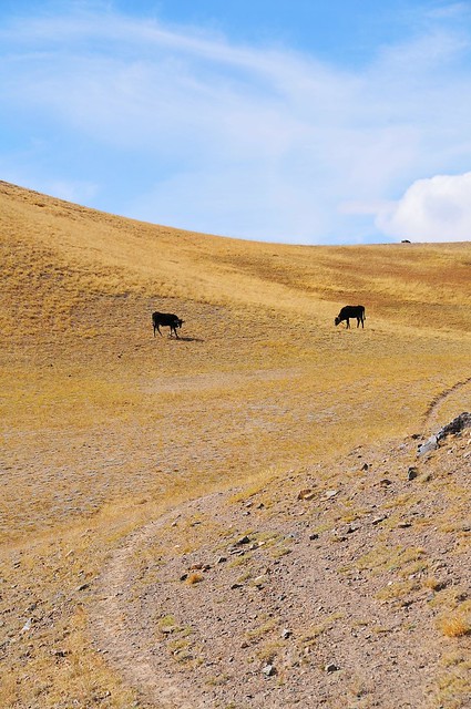
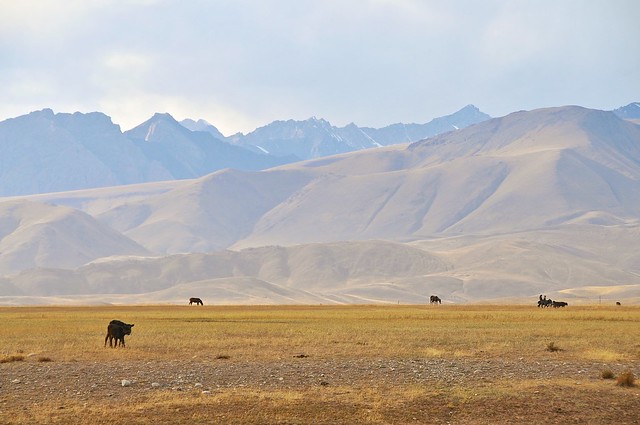
| Horses, cows, and yaks dominate: no small animals here. |
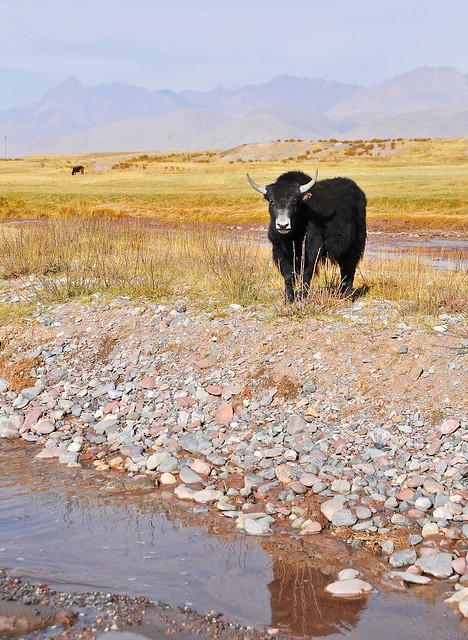 |
| Most animals just ignore the hell out of you. This yak actually noticed me. |
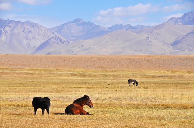 |
| A surprising donkey, which provides neither milk nor meat. |
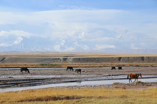 |
| South over the Kyzyl Suu towards Pik Lenin. |
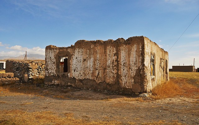 |
| Abandoned building in the village. |
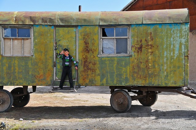 |
| Wheeled shack on the move. You see a fair number of these around Kyrgyzstan, usually near yurts. |
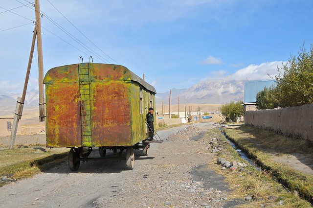 |
| This one was just being moved a short distance. |
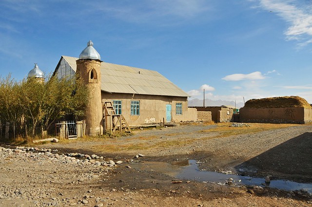 |
| The village mosque. |
 |
| The buildings are stacked with hay for the coming winter. |
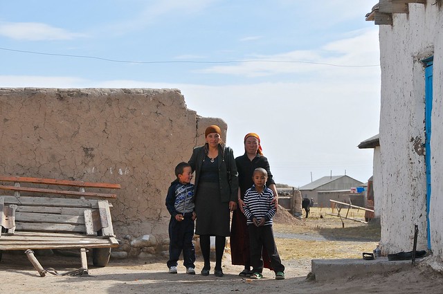 |
| This family wanted me to take their picture. |
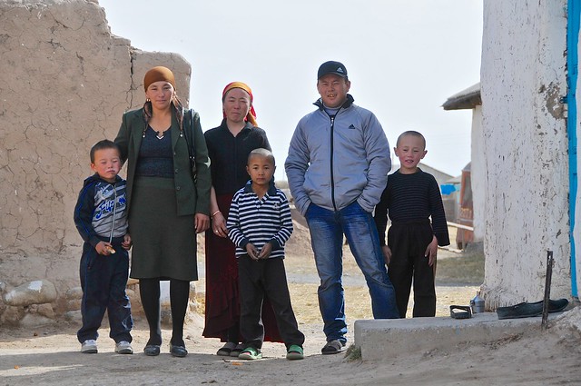 |
| Afterwards, the man wanted me to give him money for taking his picture. Nope. |
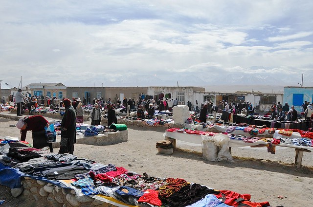 |
| The Sary Mogul market. Market days rotate between nearby towns, with each town having one or two market days per week. The shops around the square are open every day, I imagine, but much less busy. Despite being only 225 km from Osh, and connected by a good road, you might as well be in a different country. |
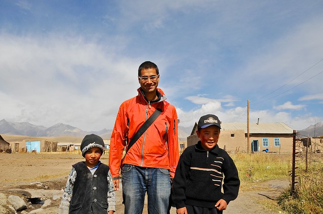 |
| Kids near the market take my picture. |
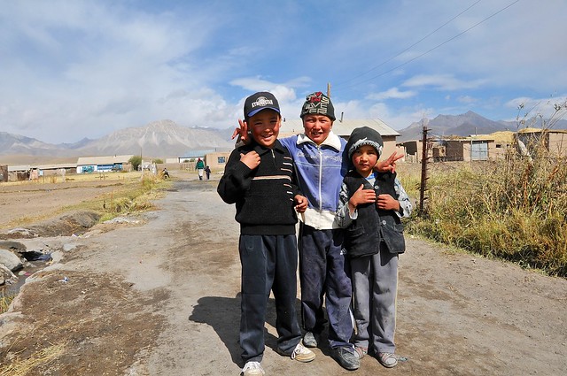 |
| All the kids in the village were super friendly. |
After picking up some food and drink at the market, I decided to head back south and to cross the river and see how close to the Pik Lenin base camp I could get. Because the mountains are so much higher on the southern side of the valley—7,000 meter peaks as opposed to 4,000 meter peaks—they look much closer, but in reality they are almost 40 km away.
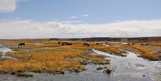 |
| Grazing in the river. |
 |
| This bridge over the Kyzyl Suu is made of pipes bundled and welded together. |
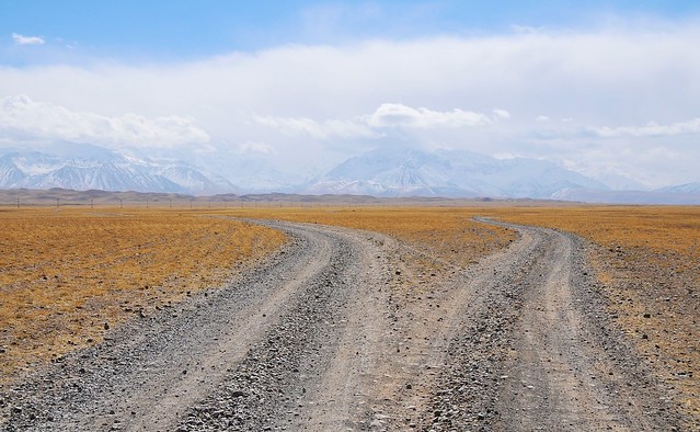 |
| I came to a fork in the road, and I took it. |
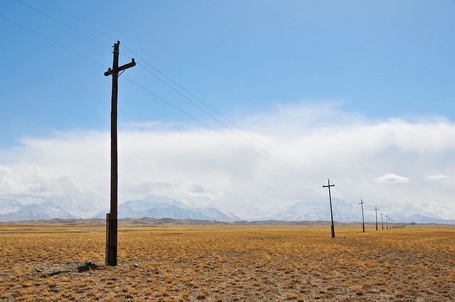 |
| Electrical lines run to... where, exactly? |
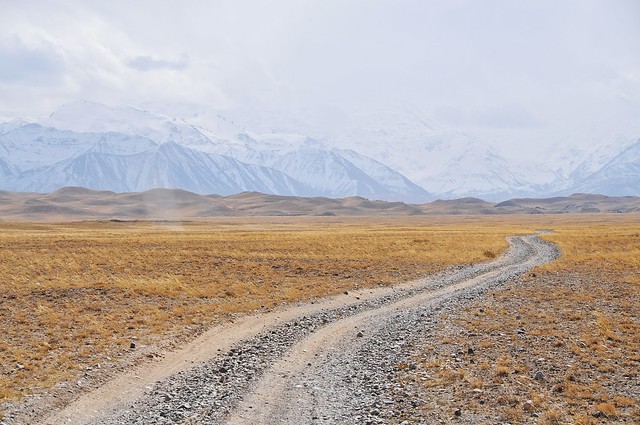 |
| You can kind of see a column of light on the left hand side of this picture. It was a little dust-devil that swept over the plain, whipping up dust. |
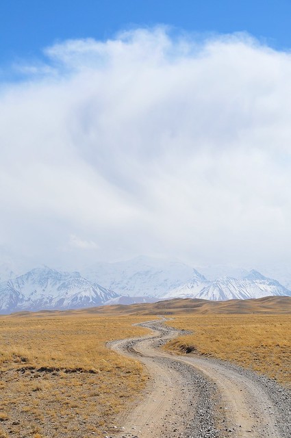 |
| I always thought the shortest distance between two points was a straight line. Maybe these curves just keep you on your toes. |
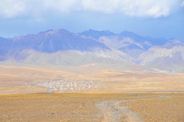 |
| Looking north towards Sary Mogol. |
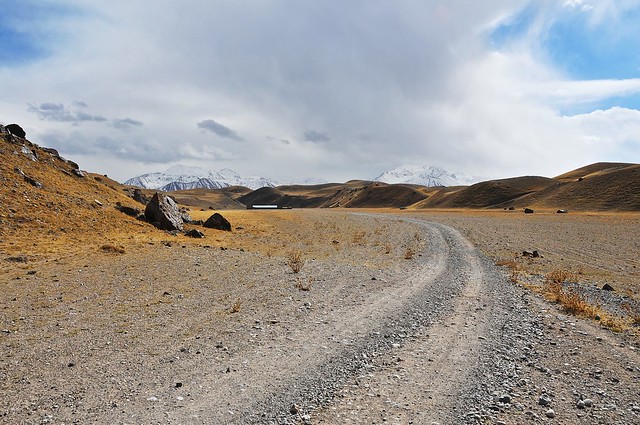 |
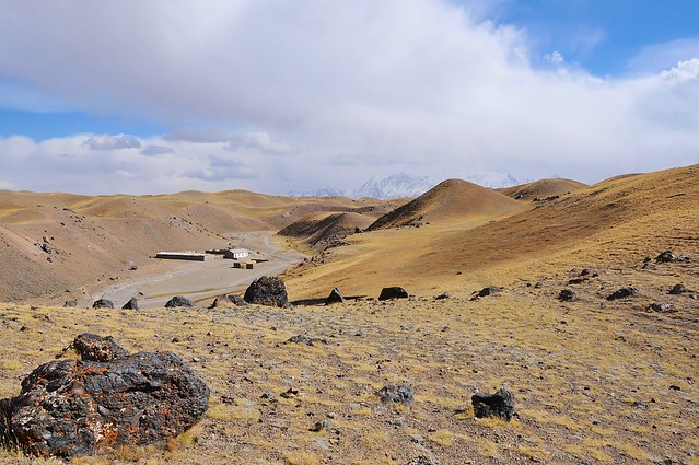
| There's a ranch-house looking building in the little valley here. It was quite large and looked a little out of place. |
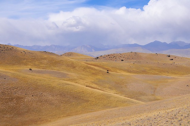 |
| Scattered livestock on the Tran-Alay foothills. |
 |
| More buildings. |
 |
| The Trans-Alay range from the foothills. The mountains really don't look that high, even though the absolute peaks are in the clouds. |
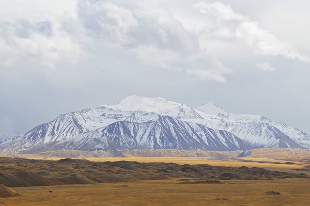 |
| Pik Lenin? |
 |
| I figured I was only about halfway to the base of the mountains, and I decided to turn back since I wasn't going to make it that close. In retrospect, I probably could have made it to a nearby lake, Tulpar Kul, had I had a GPS-equipped phone with offline maps installed. Or maybe not. |
 |
| I bet it would be nice to walk from Sary Mogol to the Pik Lenin base camp in early August. |
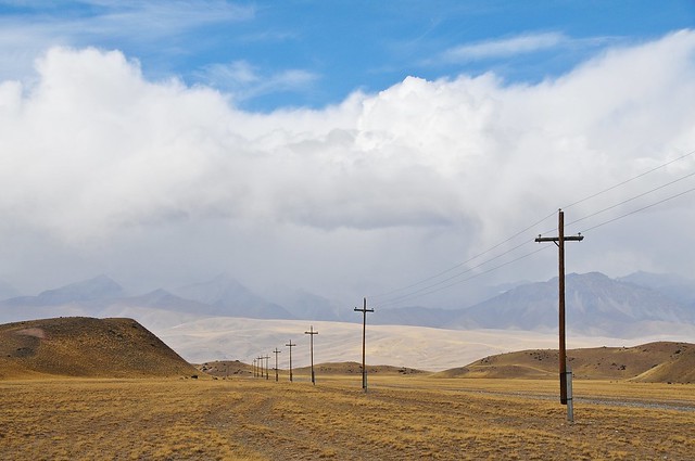 |
| You see these power lines tied to pilings in many Soviet-influenced places, including Mongolia. It makes some sense to think that they protect against groundwater-induced rotting, except that the piling themselves are often wood, and you see them in places like this that aren't exactly wet. |
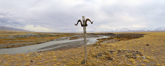 |
| Marker near the river. These curly horns appear to be from a Marco Polo sheep. |
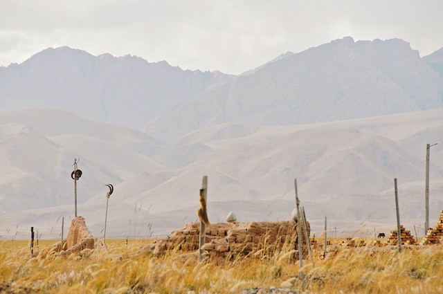 |
| Kyrgyz graveyard near town. The straighter horns belong to Ibex sheep. |
 |
| These kinds of graveyards, decorated liberally with animal skulls and
furs, hint at animistic and shamanistic traditions that inform the soft
Islam that Kyrgyz practice. |
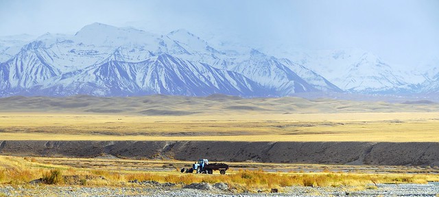 |
| An old tractor near the village. |
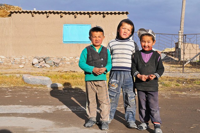 |
| More kids in the village. The light-skinned kids could be Tajik. |
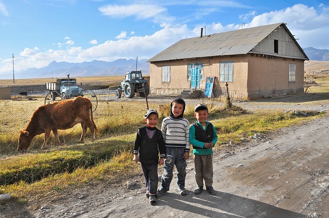 |
| They were really cute. |
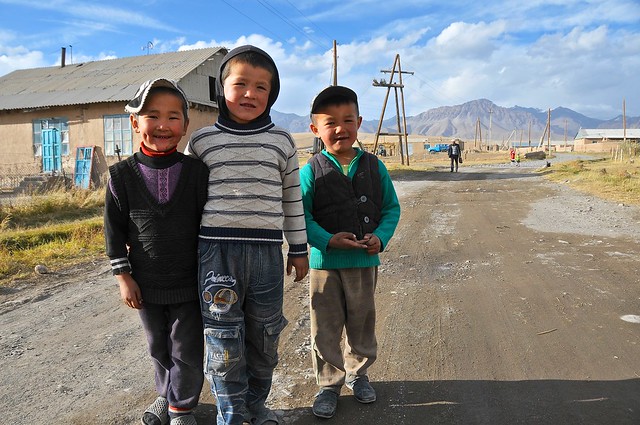 |
| Incredible smile on the one on the left. |
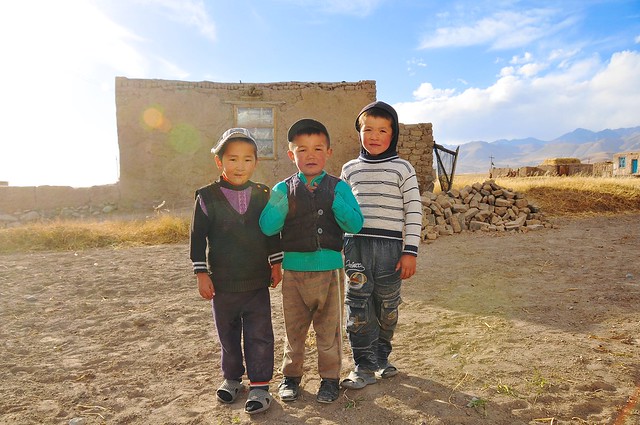 |
| Hands in the vest is a great old-man pose. |
 |
| More fun with the camera. |
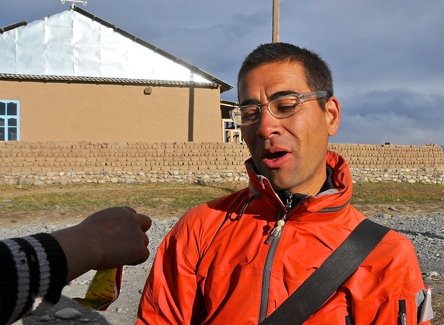 |
| Sharing some sunflower seeds with me. |
 |
| I shared my soda with them, and gave it to them when we parted. They were well pleased. |
 |
| Is it wrong to feel comforted that even the locals have to squint a lot from the light? |
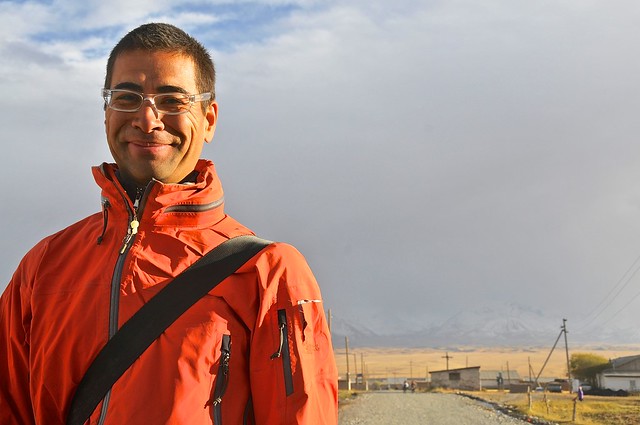 |
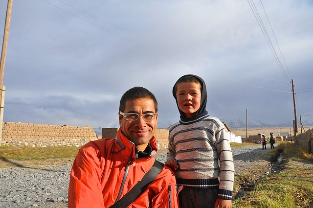
| Almost all pictures of me were taken by kids. |
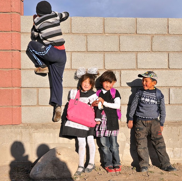 |
| These two cute girls wanted me to take their picture, but when they posed a bunch of boys jumped in, much to their disappointment. |
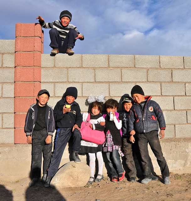 |
| Poor girls. In rural communities you can really see the second-class status that a lot of girls have. |
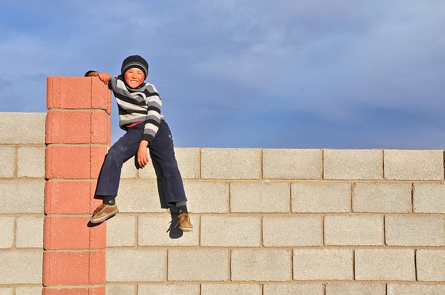 |
| Chilling on the fence. |
 |
| I took some more pictures of them after the boys left, which pleased them. |
 |
| At the junction with the main road. |
 |
| He was also waiting for a ride, except that he was headed in the opposite direction, east towards Karamyk. Apparently he lived in Tajikistan, although his Ak Kalpak hat tells us tat he's ethnically Kyrgyz, and was here visiting family. |
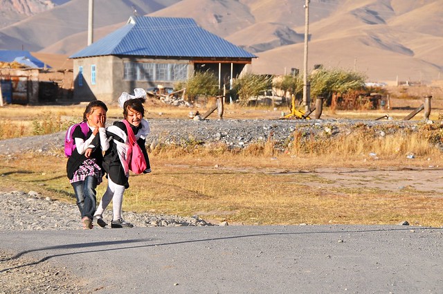 |
| The girls would stop, turn around, and wave every fifteen seconds or so. |
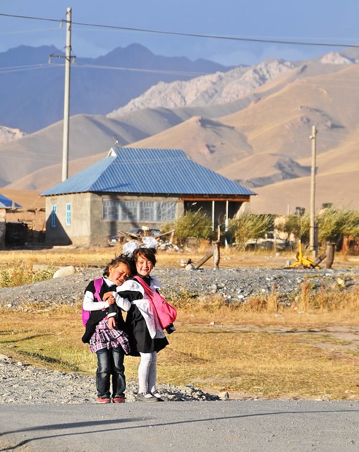 |
| Super cute. |
On the road to Sary Tash
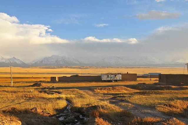 |
| After waiting for a while with no passing traffic, I decided to start walking. This is the eastern edge of town, and I was picked up soon after by a car that bargained something like 50 som to Sary Tash. They ended up not going all the way to Sary Tash, but still wanted 50 som for the partial ride? Uhhh... no. I think I gave them 30. |
I waited for a while at the village where I was dropped off, which was about halfway to Sary Tash, and took a bunch of pictures in the dying light. I then started to walk towards Sary Tash, and as I walked in the dark I was picked up by a couple of guys in in a small flatbed work truck. They were loud and boisterous, in part because of the bottle of vodka they were polishing off. I don't drink, but they insisted I have a drink so I had a small shot. We arrived in Sary Tash and they dropped me in front of a roadside guesthouse. They were disappointed with the 20 som I gave them, but it was all the change I had, and I hadn't even been hitching when they stopped to pick me up.
 |
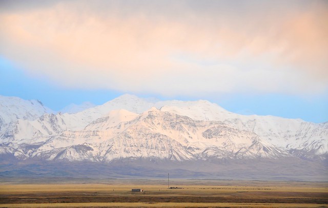
| The Trans-Alay range, with Pik Lenin. |
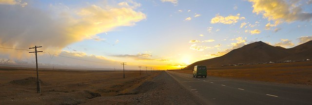 |
| A marshrutka passes as the sun sets. |
 |
| 360° view along the A372. |
 |
| Dramatic clouds over the Trans Alays. |
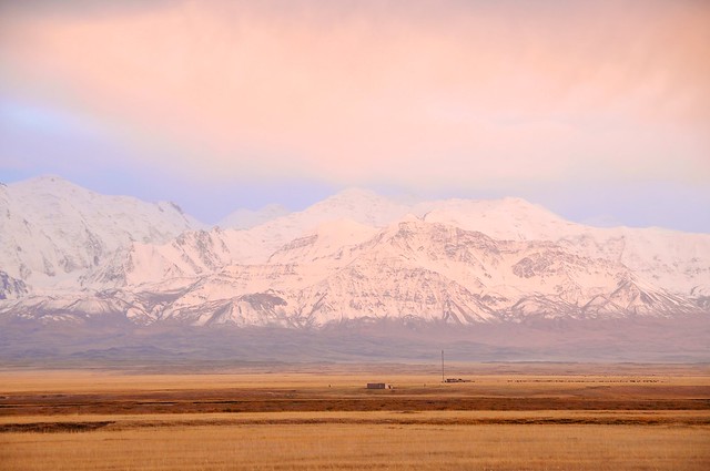 |
| Pinks and purples in the twilight sky. |
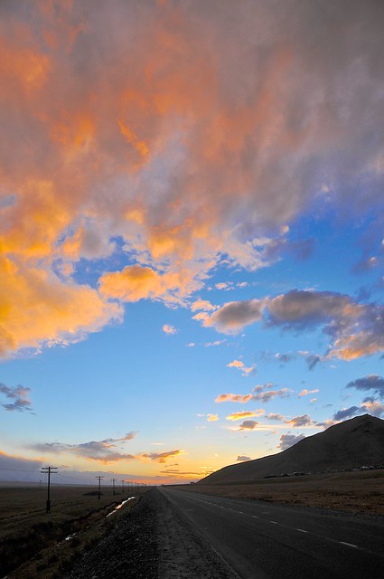 |
| The sun bids farewell to the clouds before it sets completely. |
Sary Tash
The guesthouse quarters turned out to be a large room at the rear of the building with the usual wall cabinets and karpachas. There was a heater which was a grille of expose filaments hooked up to the power source with exposed wires that hooked around each other. This heater was suspended over a bucket of water, but the filament grid was wide enough to ensure it wouldn't fall in. The toilet was an the typical outhouse at the back of the compound, next to a broken down old car. In the morning I discovered there was another guesthouse next door, except that it was aimed more at tourists with English signage (the one I was at only had Cyrillic) painted on the side. The going rate in Sary Tash is 200 som per night, no breakfast.
There isn't anything to do in Sary Tash, but I decided to walk up the hills behind the guesthouse, which gradually rise and become rockier and more mountainous as you ascend.
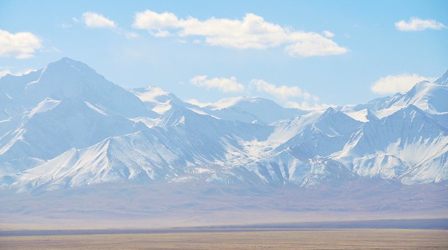 |
| View south to the Trans-Alays. |
 |
| Panorama of the northern side of the ridge, where the M41 runs on its way up to the Taldyk pass. Sary Tash is visible on the right. |
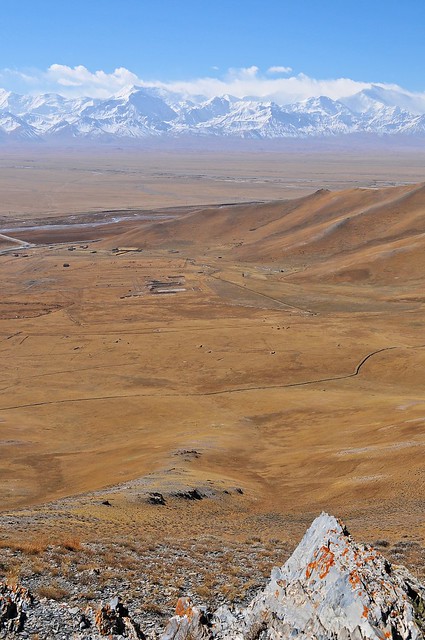 |
| Looking down the Alay valley, with Pik Lenin on the right. The turnoff for the Kyzyl Art border is just visible on the left. |
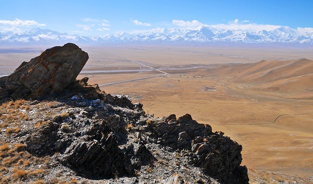 |
| The road to the Kyzyl Art pass is clearly visible here. |
 |
| 360° panorama, with south in the middle. |
 |
| Looking east along the northern side of the range. Lots of yaks were grazing on the dry grass. |
 |
| Along the Alay valley. |
 |
| The Trans-Alays. |

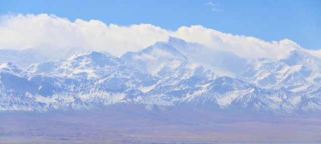 |
| Pik Lenin? None of the nearby mountains particularly stand out, so it's tough to tell which one is the highest. |
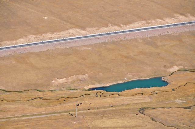 |
| Tiny, aquamarine pond by the M41. |
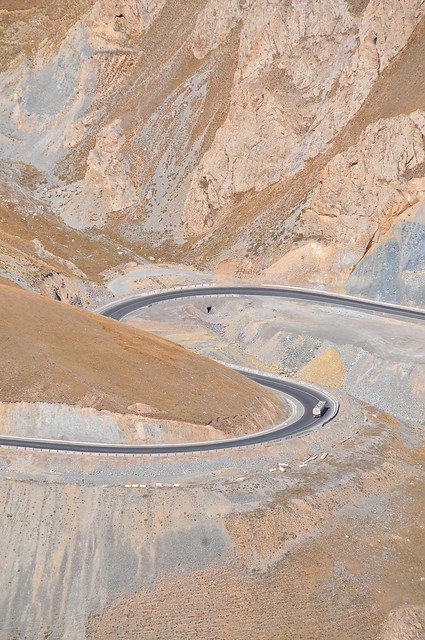 |
| Tanker taking an S-curve on the way down from the Taldyk pass. |
 |
| Looking east, with the Alay valley on the right, Sary Tash n the middle, and the M41 to Taldyk on the left. |
 |
| Clouds dapple the nearby mountains. |
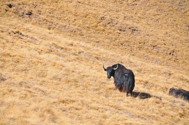 |
| Hello, Mr. Yak. |
 |
| No shepherds for the large animals. |
 |
| Another 360° panorama. After this the ridge got steeper and jagged, so I backtracked and headed down. |
I decided to keep walking around the mountains and to spend another day in Sary Tash. Although there are a few stores and chaikhanas around Sary Tash, most of them only seem to serve food at specific hours. There's a truck-stop style chaikhana on the M41 a just northwest of town, and I was able to get a meal there. Across the road, there's what appears to be a construction-worker's compound that was used mainly during the road construction, when Chinese workers built the road. Lots of the truckers are Chinese, and it's a shame that even in a poor country like Kyrgyzstan Chinese companies use Chinese workers.
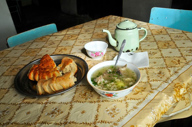 |
| Shorpo and naan, in a trucker's chaikhana. The congealed fat floating in the soup is a good thing, by Central Asian standards. The thick, dense bread always seems stale in the mountains, and is such a disappointment after China's great naan. |
 |
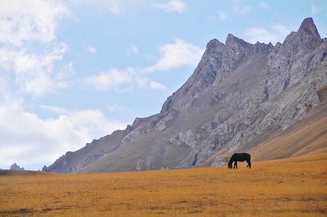
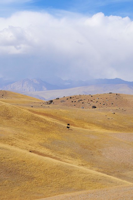
| Lots of livestock on the mountains north of town, too. |
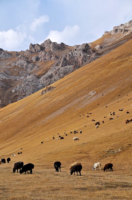 |
| With smaller animals they do seem to use shepherds. |
 |
| In the height of summer, when the grass is green, this must look amazing. |
 |
| There was a lone shepherd guarding these sheep. It must be a really boring job. He was curious, and came over to say hello, but then had to leave to chase a young sheep which had decided to break away from the flock. It really didn't want to be caught, and would let the shepherd get close before running away and eluding him. It took about ten minutes of running up and down the mountain to catch it. |
 |
| Sary Tash is nestled between the ranges, on the near right. |
 |
| 360° view from a little higher up. |
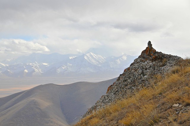 |
| Looking towards the Trans Alays. |
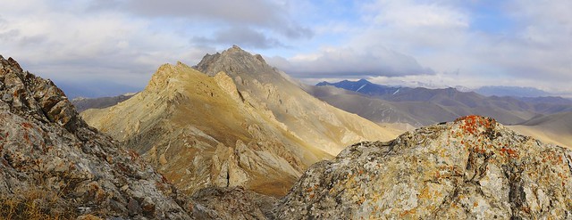 |
| Looking east from near the peak. |
 |
| Sary Tash from the top of the mountain, at the 3,643 meter At Jolu pass. |
 |
| The southern slopes are grassy, but the northern slopes in the Kurshab valley are much rockier. |
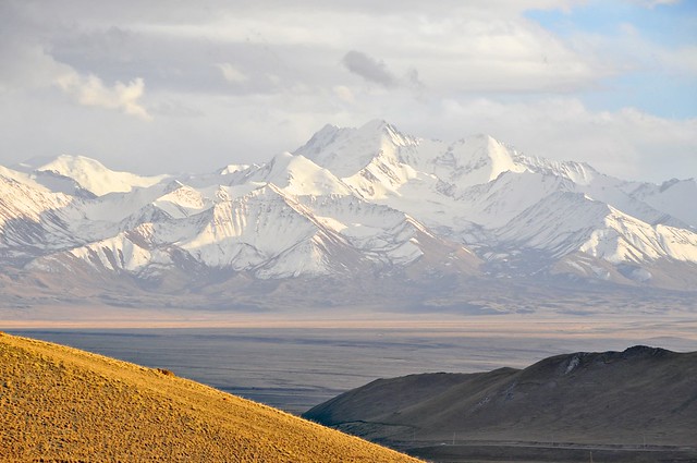 |
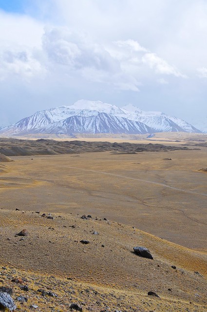
| Who the heck knows what mountain that is? Gora Kurumdy? It's big, whatever it is. From closer to the foot of the mountain it would look much less impressive, however, as you would only be able to see the nearest subpeak. |
 |
| Swampy grassland just north of town. |
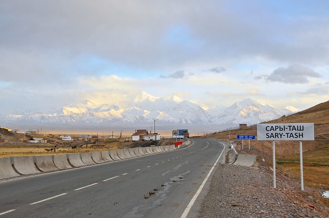 |
| Enteing Sary Tash from the north. |
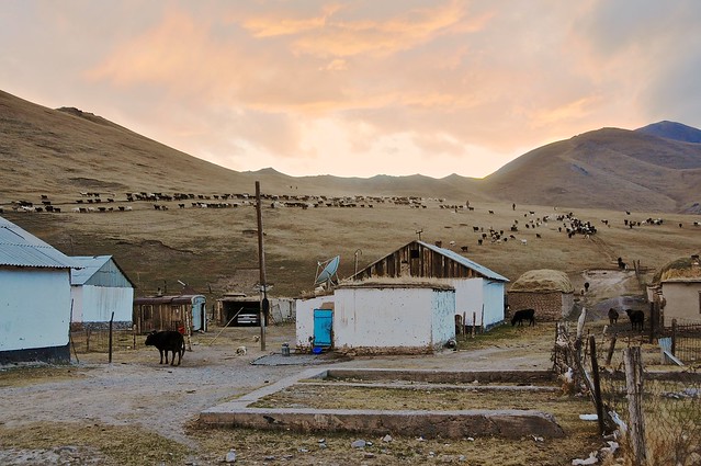 |
| Sheep coming down the mountain in the evening. |
I bought some food from a nearby store and satisfied myself with bread, salami, and soup for the night. I had no idea what
halva was, but it had pictures of sunflower seeds on the side, so I bought a pack. it's supposed to be some form of candy, but mine was basically a block of sunflower paste. It's probably better than Snickers as a food for the mountains, because it's just gross enough that I wouldn't eat it unless I was quite hungry. I've sometimes heard that cans of dog food are the best things to put in an emergency survival kit in your car, on the same principle that you won't actually eat it unless you really need to.
The plan for the next day was to walk over the mountain range I had climbed the day before, and descend down the back side into the Kurshab valley, where I could meet up with the M41 and hitch a ride to Osh.
 |
| Rolling hills and deep blue skies. |
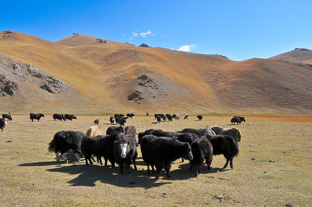 |
| Yak herd in the valley. |
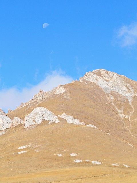 |
| Looking up the mountain, with the moon behind. |
 |
| The easiest way up the mountain is to simply follow the power lines. Things were much more difficult carrying my bag, and I would have to stop every couple of power poles in the steeper sections. |
 |
| At the pass. My bag is on the left. |
 |
| Looking down the back-side, into the Kurshab valley. |
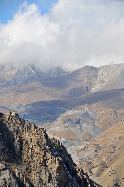 |
| Switchbacks up the Taldyk pass. |
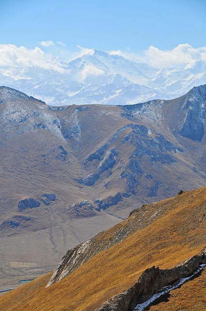 |
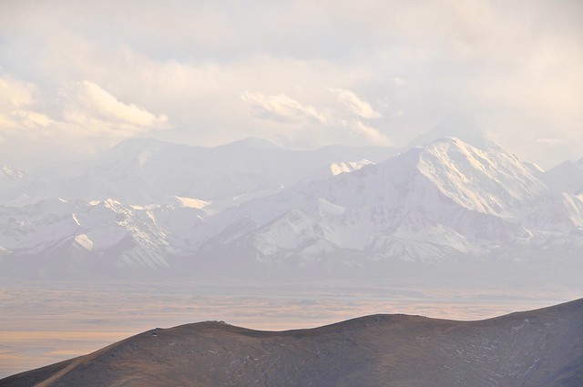
| Pik Lenin over a couple of mountains. |
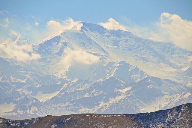 |
| The clearest view of the usually-clouded Lenin. |
 |
| 360° from the Ak Jolu pass. |
 |
| Sary Tash. |
 |
| Looking south. |
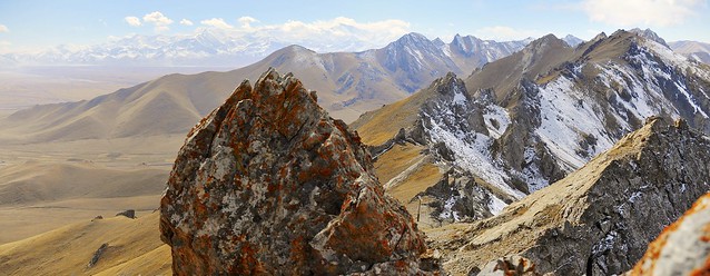 |
| Snow lingers on the north side of the mountains. |
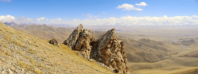 |
| Sary Tash on the right, and Irkeshtam on the center-left. |
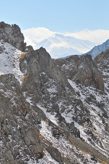 |
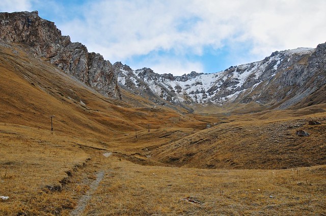
| View of Lenin as I descend down the northern side of the pass. The path down this side of the mountain is very clear and walkable, and probably a little more difficult going down than up because of the loose stones that can sometime make for slippery footholds. |
 |
| View from two-thirds of the way down the way down the pass. The final third is full of small trees and shrubs, though there is a good path through them. |
Once I reached the M41 I started walking towards Osh. There was virtually no traffic on the road, so I kept walking. As I neared a village I saw a small sluice gate blocking the roadside stream, with water being diverted into a pipe that subsequently ran into the village. This was kind of like the running water I occasionally saw in Arslanbob, and it ran to a centralized, public, water source in the village. This water source was sponsored by the Aga Khan foundation, which as I was to discover plays a huge role in development in the Tajik pamirs.
I kept walking, and the weather got greyer and colder as I did. The locals who were outside were all standing next to buildings, using them as cover from the wind. As I trudged past a village market, some local drunks called me over, wanting to talk. I admit to being annoyed: if you actually want to talk to me (i.e., ask me where I'm from, if I have a family, etc.), why don't you actually come over and talk to me instead of asking me to walk over to you? Well, maybe they wanted to buy me some drinks, but I'm pretty sure to these guys I was just a convenient source of diversion. I didn't stop.
After walking an hour or so, I successfully flagged down a car. Only a few had passed me on the way to Osh, and most of them were full. There were only three people in this car, and they were going to Osh. The passenger sitting in the back did the negotiationg, and we bargained down to 430 som. Lonely Planet suggests Osh-Sary Tash should be 350 in a car, but this seems pretty low given that a marshrutka is 300. Others were saying that about 500 was the going rate (and Sary Mogol 550), so 430 from where they picked me up seemed reasonable.
When we neared Osh they asked where I wanted to be dropped, and I said the Taj Mahal. Most drivers seem to know it, but I guess these guys didn't because they stopped at a chaikhana on their way into town and asked people. I thought we had stopped for some other reason, and was a little annoyed because we were so close to town, but it's only after they go back in the car that I understood they didn't know where it was. I gave them directions and they dropped me off in front of the hotel.
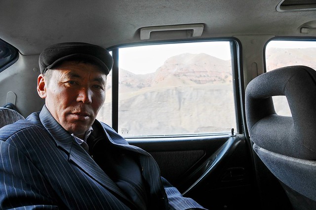 |
| My back-seat companion and negotiator-in-chief. |
Budget
October 3, 2012 from Osh to Sary Moghul: 3,100
- GBAO permit through Osh Guesthouse: 1920 som ($40)
- Coffee, samsa, meat pastry, and cake at cafe next to mosque: 55 som
- Instant coffee, fig snack, walnut Pic-nic chocolate bar, Halls: 94 som
- Apples: 30 som
- Pomegranate: 20 som
- 500 grams strawberries: 60 som
- Taxi to Sary Moghul: 700 som
- For the family I stayed with: 220 som
October 4, from Sary Moghul to Sary Tash: 500
- Bed at guesthouse: 200 som
- Apples: 40 som
- Cola: 25 som
- Ride to Sary Tash: 50
- Bread: 40 som
- Salami: 105 som
- Coke: 45 som
October 5, Sary Tash: 405
- Bed: 200 som
- Shorpo, naan, tea: 200 som
- Coke, Halva (sunflower paste): 85 som










No comments:
Post a Comment