Showing posts with label hiking. Show all posts

Friday, 5 October 2012

Kyrgyzstan's Alay Valley in autumn: Sary Moghul and Sary Tash


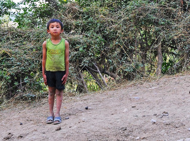
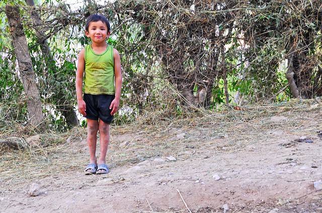
My earlier decision to sleep at the Taj Mahal but use the nearby Osh Guesthouse for information was a good one, as the Taj Mahal is much quieter and allows for better sleep. After waking up refreshed I stopped by the Osh Guesthouse in the morning to see if they had received my boots. Boots? Yes, boots. You see, my Blundstone boots had developed a rip in the leather where it joins the sole— a chronic problem, as this was the second pair to develop the same problem, and I already had the first pair replaced in the US under warranty.

Blundstone: horrible US warranty service, amazing Australian warranty service

Getting warranty service on the first pair was not easy, as I didn't have the receipt and didn't live close to where I bought them. I contacted Blundstone's US distributor, but they never returned my emails. I finally resorted to contacting Blundstone Australia directly, and after sending them a couple of pictures showing the problem, they airmailed a pair of replacement boots from Australia! That's pretty amazing, even if their US distributor is crap.

So when my replacement pair developed the same problem in Mongolia, I was pretty disappointed, especially since it meant my right foot would now get wet in shallow puddles (Blundstones are waterproof for brief periods, and walking through ankle-deep water usually isn't a big problem). Given my prior experience with Blundstone Australia, I figured they would help me out, but being on the road I didn't really have a good place to get them sent. But when i went through Osh the first time, knowing that I would be back there in a few weeks on my way to Tajikistan, I asked at the Osh Guesthouse if they had an address I could get stuff sent to (and how safe it would be to do so). They said it should be pretty safe, as they would just get a note in the mail telling them to come pick something up, but that it could take a while to get there. I asked Blundstone Australia if they could send out a replacement to the Osh Guesthouse, and they readily agreed to.

GBAO permit through the Osh Guesthouse

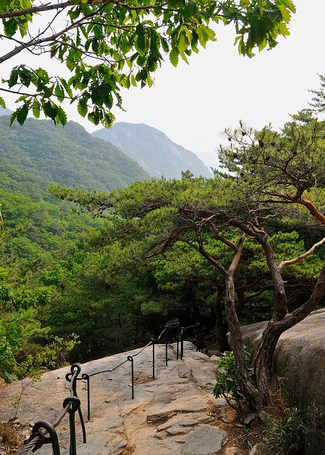
I had hoped that the boots would have arrived safely by the time I got back to Osh, but they weren't there. While talking to the guys at the guesthouse, however, and talking about the problems of getting a GBAO permit and inquiring as to whether the pamirs were really open for tourists, I was told that not only were the pamirs open and permits being issued, but that I could get a permit from them at the guesthouse. It would take a few days processing and $40, but it was possible. This was great news for me, as it would mean I could take the direct route from Osh to Murghab, instead of first heading to Dushanbe and backtracking to the pamirs and coming back to Osh on my way out of Tajikistan.

I applied for the GBAO permit and decided to spend the processing time in the villages of Sary Mogol and Sary Tash in the Alay Valley near the Tajik border. This was the same valley I had driven through as I entered from China, and from Sary Mogol you apparently have great views of Pik Lenin, a 7,000+ meter peak on the Tajik border.

Osh's CBT office: not helpful

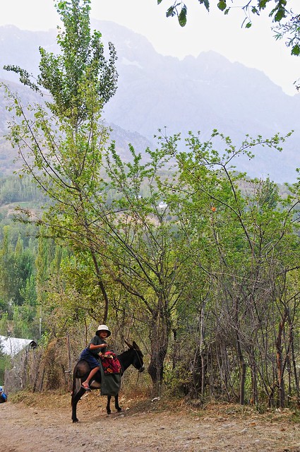
I went to the Alay Hotel, where the regional CBT office is located, to see what sort of options CBT had in the region and to see if I could reserve a spot in the Sary Mogol CBT homestay that night. The CBT office was really quite unhelpful, telling me that they wouldn't call the Sary Mogol homestay and that I could simply arrive and find the home-stay quite easily as everyone knew where it was. It's easy to see why the system isn't working as well as it could, as I described in my Arslanbob post. I suspect that if I wanted a service for which I would have directly paid the guy at the office he would have been more helpful.

I went down to the marshrutka and taxi stations near the market to see if I could get a ride to Sary Mogol, and ended up finding a ride in what Lonely Planet calls the Agromak 4WD stand (which is really just a big parking lot behind some street-front blocks, and most of the vehicles are not 4-wheel-drive. I ended up grossly overpaying, as I apparently agreed to pay 700 som for a ride to Sary Mogol, which Lonely Planet says is twice what I should have paid (though I think their prices for the Osh-Sary Tash route are too low). It seemed reasonable in light of the 1,000 I paid from Irkeshtam, but c'est la vie. I hate haggling, especially since it seems entirely haphazard whether the driver initially quotes you a fair price or a wildly-inflated price.

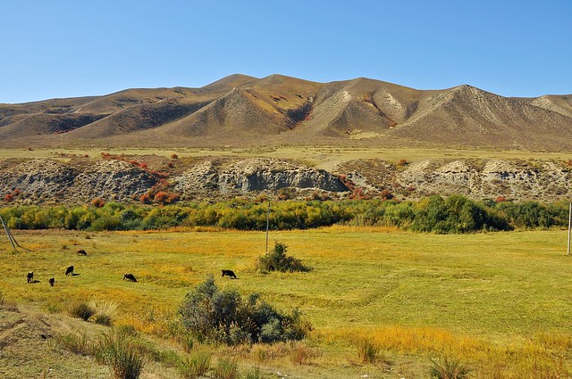
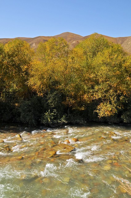
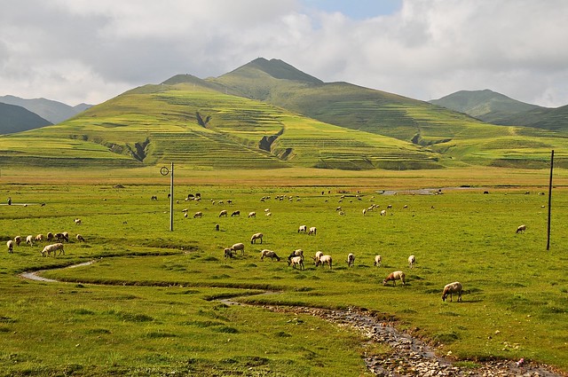
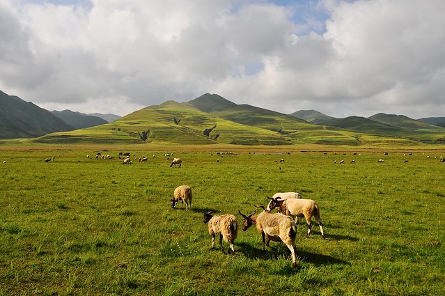
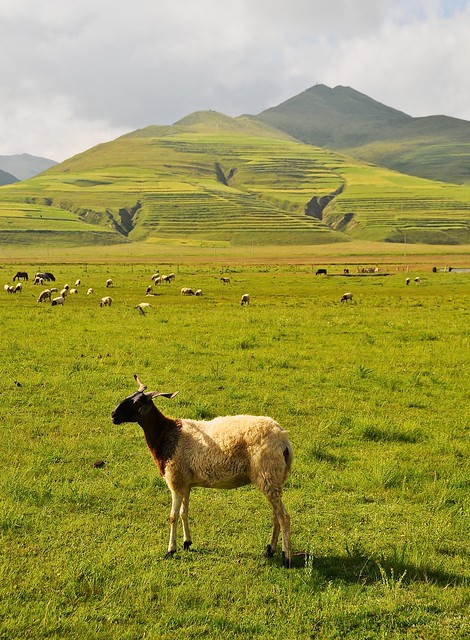
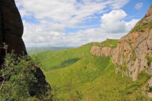
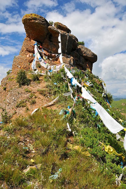
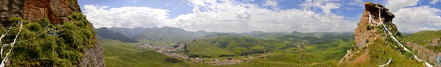
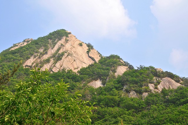
The M41 between Osh and Sary Tash

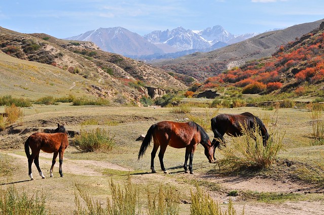
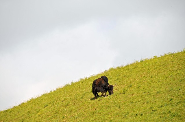
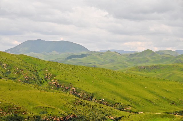
The ride up to Sary Tash would be the first time I had done this stretch of the M41 during the day, and it was really quite impressive. The first half hour or so from Osh is relatively flat farmland that is part of the Ferghana valley, but it eventually starts to climb into a mountain valley, culminating in the 2,391 meter Chiyrchyk Pass, some 80 km from Osh. After that pass you drop down into the town of Gulcha (1,546 m) and up the Kurshab valley. Whereas the mountains before the Chiyrchyk pass were grassy and green, the mountains in the Kurshab valley are red and craggy, with a wide and stony riverbed that looks tame and narrow in the fall but must appear very different during the spring melt.

At a couple of places along the road, where the valley was narrower and the highway had more bends, I saw wrecked tractor-trailers. For the most part they had failed to negotiate a corner and had gone straight off the road. I had a difficult time imagining that the government really cares that much about removing wrecked trucks from the sides of roads, so I imagined that they had been there for some time. I was wrong about this, however, as when I returned to Osh a few days later they were gone (maybe they are valuable as scrap?). I suspect that these crashes may have been fatal, as nobody in Central Asia likes to wear a seatbelt, and drivers (and front-seat passengers) only pretend to wear them by slinging them across their bodies when they pass police checkpoint. In fact, wearing your seat belt is likely to be taken as an insult by your driver, who will proceed to tell you how good a driver he is. Such a good driver that not even the argument that you are protecting yourself from the other bad drivers on the road will be satisfactory: he's so good he can avoid those bad drivers.

_DSC1201
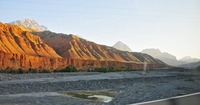
The Kurshab riverbed and mountains after Gulcha.

_DSC1203
The lower mountains are surprisingly grassy.

Saturday, 29 September 2012

Jeti Oguz, or where I reasonably fear I might freeze to death on a mountain

After wandering around the market perimeter trying to find out where marshrutkas to Jeti Oguz would leave from, I finally found a formal station near the stadium where marshrutkas left from (in the 2014 Lonely Planet it's marked as the Southern Bus Station, but it was unmarked in the 2012 edition).Before getting there I bought some supplies while I was in the market, as I figured the options in Jeti Oguz might be limited. Chocolate bars are a reliable (and compact) source of energy which are easy to take with you when hiking, and I had been  buying a lot of them since I was in Kyrgyzstan (and often snacking on randomly instead of keeping them for occasions when I would be away from other food sources).

I caught marshrutka 355 from the Southern Bus Station, which stops in Jet Oguz village and continue all the way along the southern shore of Issy Kul before ending in Kochkor. Jeti Oguz Village is still a good 10 km from the sanatorium where the famous rock formations of broken heart and the seven bulls are located, and I started to walk, figuring I could probably try to hitch along the way. Two other western tourists were on the same marshrutka, and they seemed to have the same idea. Although I started out ahead of them, they soon passed me as I kept stopping to take pictures, and they were hitched a ride after a kilometer or so of walking. As both the weather and the views were nice, I decided to keep walking.

_DSC0803
Not far from the village, I came across a couple of super-skinny little puppies by the side of the road.

_DSC0804
I fed them the sausage I had been carrying around since I saw that starving kitten in Pingyao. They were so unused to people they bit my fingers, too.

_DSC0806
I hope they survived.

_DSC0809
View to the west.

_DSC0810
The Jeti Oguz river.

_DSC0814
View to the east. There were lots of horses in the valley. Probably more horses than cows.

Saturday, 8 September 2012

Arslanbob

The Marshrutka to Arslanbob drops you off in the town square, which is essentially a big gravel parking lot with a small statue in the middle. A short walk uphill along the river from the square is the CBT office, which should be your first stop.

CBT, or Community Based Tourism, is a Kyrgyzstan-wide tourist initiative that helps connect tourists with local homestays and tour guides. The basic idea is that the central CBT offices help train the homestay and service providers, while certifying their offerings (homestays are classified according to the amenities they offer) and providing centralized booking services. In return, they receive a commission of about 15%, with the remainder going to the local operators.

CBT was launched in 2000 by the Swiss NGO Helvetas, and my understanding is that they provided significant start-up funds, training, and infrastructure support. Unfortunately, CBT seems to have gone through some growing pains when Helvetas withdrew and turned over all operation to local Kygyzstanis. Some of the more popular homestays disliked paying a commission to the local CBT office, and withdrew. Some of the CBT booking offices started directing most or all tourists to favored homestays they might have connections with, meaning that only a select few providers actually benefited from the scheme. CBT offices throughout the country continue to offer varying levels of assistance, expertise, and availability, making it difficult to evaluate the CBT as a whole.

The CBT office in Arslanbob seems to be one of the best-run offices in the entire country, even if it does seem to support an unsustainably high number of homestays, at 18. They seem to provide fairly impartial allocation and travel advice/information, even trying to develop skiing in the area. They can also provide internet access through a cell-phone based modem, but this is pretty pricey.

Anyway, I opted for an English-speaking host, and homestay #13 was suggested to me. This was located a kilometer or so west of the square, near the access road leading up to the plateau that sits to the southwest of the village. The homestay was really quite nice, with all of the guest rooms located in a separate building with about three bedrooms and a common room that could collectively sleep about a dozen people. The houses feel quite Russian, with stucco walls, pastel colours, and lots of lace and floral prints.

As with most places outside of the major cities, there is no real plumbing and no sewer, which means long-drop outhouses. In practice, this typically entails a separate outbuilding with a cement floor with a narrow slot in it: a squat toilet. Even though it's an outhouse, you don't throw your used toilet paper down the hole, but in a bin next to the toilet (outside of Japan, it has been the norm to put used paper—which you've typically supplied yourself—in a bin and not down the toilet). Depending on how well the toilet and pit has been maintained, it might not even be that unpleasant an experience.

Even places with long-drop toilets typically have hot showers, as it really doesn't require much more than a hot water heater and gravity. They'll be placed in another area, sometimes even in places with dirt floors, and while gravity alone doesn't lead to very good water pressure, they get the job done... just be sure to wear your flip-flops.

The host of our homestay was a schoolteacher who had been mayor of the village in the past (one of his prouder achievements as mayor was to eliminate hard alcohol from Arslanbob), and he—like over 90% of the village—was Uzbek. It's a little surprising to find so many Uzbek (the population of Arslanbob seems to be almost 10,000) in the mountains, but there is a surprising amount of farming in the village. Like most Uzbek families, this one was large, as I believe he had something like seven children, and would have been happy with 10 (it's a nice round number, and why wouldn't you want 10?).

_DSC9859
This stream runs in front of the homestay I stayed at. Even at the end of summer there was still abundant water flow from high-elevation snows and glaciers, and these streams (which run everywhere) are the source of water in Arslanbob, which otherwise has no central plumbing system and certainly no sewer: this was one of the only pipes I saw, as most water was sourced directly from streams.

_DSC9861
Looking down the road up to the plateau. Everyone was coming down from a day working the fields up there, by ancient jeep, truck, donkey, and foot.

_DSC9865
Apparently kids in Kyrgyzstan pose like soldiers at attention.

_DSC9868
At ease.

_DSC9869
Donkeys are a common form of transport, mainly for young kids and old men.

Saturday, 11 August 2012

Langmusi: Tibetan Amdo on the border of Gansu and Sichuan

There's a direct bus from Xiahe to Langmusi, but it leaves early in the morning, and often sells out; if you miss it, you have to connect in Hezuo, which is midway between the two. The bus takes about four hours, or slightly longer with stops. You can find a nice list of your bus options to Langmusi here.

Helit and I met a Spanish schoolteacher on the bus, and we ended up sticking together for the bus ride and our time in Langmusi. Other than us, almost all the rest of the passengers were excitable Chinese tourists. We stopped a couple of times on the way: once by a lake, where all the Chinese jumped out and rapidly snapped pictures and ran for the bathroom; and once on a plain near some Tibetan herders who were waiting for the bus and sold the Chinese tourists short horse rides.

_DSC6979
A yak at the second stop.

_DSC6981
I took pictures while the Chinese took short horse rides. I'm sure the bus driver got kickbacks from the herders cum horse-wranglers.

_DSC6982

_DSC6984
The sheep have horns. Unlike the sheep I would see in Central Asia, these are not fat-tail sheep.

Unlike the trip from Langmusi to Xiahe, it's not really that noticeable that you're going uphill, but the elevation changes from the 2,900 meters in Xiahe to about 3,300 meters in Langmusi.

We arrived around noon, and then searched for somewhere to stay. The Chinese construction boom had reached Langmusi, with both roadworks and hotel construction was in full swing, and tourism seemed to be booming. A symptom of this was that beds were in short supply, and it took a while to find a place to stay. We found a place in the Muslim quarter, and run by Tibetans. It had a nice front patio perched over the stream, and although the rooms were nice the bathroom facilities were even worse than the Overseas Tibetan Hotel: they positively reeked of ammonia. Thankfully, they were so ill-lit that you couldn't fully grasp how dirty they were.

I saw a couple of other hostel bathrooms in Langmusi, and they were no nicer, with with squat toilets that visibly flushed into ditches, and things like that. The Chinese very much take these sorts of setups in stride, which is hardly surprising given that even in major cities you can find bus-station toilets that are just tiled trenches a couple of feet deep, and everyone just lines up over them and squats, with "flushing" happening when water is periodically run down the ditch to wash the shit away. Bathrooms are dirty places where dirty things happen, and that's an accepted fact of life.

Anyway, after finding a place to stay, we set out on a hike to the Red Rock Mountain just west of town, which you pass on your way into town. We had seen some maps made by a tour outfit, and it looked like it would be fairly straightforward to circle around to the far side of the mountain and ascend it from there. Unfortunately, the map was wildly misleading and the road that was supposed to be the beginning of the path quickly deteriorated into an empty, unmarked field with no discernible path to the top, but lots of thick bushes. Stubborn as I am, I wasn't going to give up, so I pushed onwards up ever steeper and more hostile slopes while the girls turned back. I ended up having to scramble and crawl my way up through a steep section to summit one part of the mountain, only to have to retreat and re-ascend to get to the main mountaintop, as I was on a secondary peak.

_DSC6985
The view from midway up the mountain, before things got tough.

_DSC6986
If this is the view you get when you're climbing Red Rock Mountain, you're doing it wrong. I had just scrambled up and through a thicket of trees like you see on the left and bottom of the screen.

_DSC6996
It wasn't that difficult, as Tibetans obviously make it here with some frequency.

_DSC6997 - _DSC7005
The view of the town from the secondary summit.

Tuesday, 26 June 2012

Hiking Hong Kong: High Junk Peak to Po Toi O village

After my successful hikes in Busan and Seoul, I thought I would indulge in some of the trails I had read were available in Hong Kong. The NY Times had extolled the options available in the New Territories, and High Junk Peak in particular was highly recommended.

Getting to the start point is pretty easy: take the MTR to Hang Hau station, and then catch minibus 103 from nearby, getting off at Ng Fai Tin. Alternatively, you can also take minibus 103M from a slightly different spot. Minibus 16 also runs the route, but less frequently. Your options should be shown on the map below.


_DSC2244
Hang Hau Man Kuk Lane Park. Hang Hau station is underneath those apartment buildings.

Temple near Hang Hau station
There are some temples and tombs in the hills east of Hung Hua station.

Incense
Incense in front of Tin Hau temple.

I walked to the trailhead instead of taking a bus. Be sure to buy some water at one of the shops around Hang Hau station or at a supermarket on the way to the trail.

Map of the trail, from hiking.gov.hk.

The trail begins
The path plunges immediately into nature, and it would be easy to forget you're mere minutes from skyscraping apartment buildings.

Looking back
Looking back towards the trailhead.

Tall grass
You go in and out of groves of trees and tall grasses the completely obscure all traces of the city.

360° on plateau before High Junk
360° panorama after the first hill.

_DSC2344
The city reminds you of its presence as you go higher and enter open space. It's possible to see all the way to Central Hong Kong and Kowloon.

High Junk Peak
High Junk Peak shows itself.

Tall grass and High Junk
Back into the tall grass.

Starting the ascent
The ascent begins. 

Hiker coming down
Hikers on their way down.


Up the peak
Mid climb.

_DSC2350
Beginning to descend.

_DSC2383
There's a plateau after the initial descent.

Above Po Toi O village
Po Toi O village from the trail.

Tai Miu temple
Tai Miu temple lies at the end of the trail. It took me just under three hours to get here from the start of the trail, and it could be done in much less time if you don't take 150 pictures along the way.

Tai Miu temple is on the right-hand side of the trail, towards Hong Kong. Po Toi O village is on the opposite, left-hand side. It's a small village absolutely filled with seafood restaurants built on stilts over the water, many of which will seat more customers than there are residents in the village: obviously a popular dining destination (but not when I was there, at 5:30 on a Tuesday afternoon). Each restaurant has a display of live seafood out front, and this was the first time I had ever seen mantis shrimp. They look pretty vicious, and they're transported in individual plastic tubes to prevent them from thrashing about. Compared to Jagalchi, the restaurants here seem more hygenic, although the selection is more limited.
Mantis shrimp
Mantis shrimp in Po Toi O.

Getting back from Po Toi O, you can take minibus 16 back to Hang Hau. It only runs once or twice per hour, though.


Peter Lam has some nice pictures of the trail on his blog.

Train tickets for the T100 to Shanghai

After picking up my Chinese visa in the morning and hiking High Junk in the afternoon, I bought my train ticket to Shanghai. Trains to Shanghai and Beijing depart for one of the cities each day, alternating between the two on each day. I was slightly conflicted about which one I should take. The train to Beijing was abetter deal and would save a fairly long and somewhat costly trip between the two cities, as well as save me some travel time for later, especially since I could leave the next day (Shanghai was in two days). On the other hand, I've never been to Shanghai and it seemed like a bit of a shame to bypass it on my way north. Even though I've heard some fairly poor things about Shanghai, I decided I couldn't miss it. (This kind of fear/regret-based decision making doesn't always lead to the best decisions.)

Although the trains from Hong Kong all leave from Hung Hom station in Kowloon, you can also buy your tickets at a secondary MTR tourist office in Admiralty Station, on HK island.

Fares are quite cheap, given that it takes 19 hours to Shanghai and 24 hours to Beijing, with the upper bunk in a hard sleeper compartment being 508 HKD to Shanghai, and 574 HKD to Beijing (actually, I think the hard sleepers on these trains only have 4 bunks per compartment, so they are really priced for lower and middle bunks only). And unlike most Chinese trains, it's not that difficult to actually get tickets. I booked two days in advance without any problems (and my cabin wasn't full), whereas in China you need to basically book as far in advance as possible and hope to get lucky.
Hard sleeper on the T100, courtesy wikipedia.

Hard sleeper on these trains (or at least the train I took) are nicer than on any Chinese train I've seen. They are actually enclosed at both ends, with only an open doorway (most hard sleepers have the end of the beds facing the hallway exposed to the hallway), and storage in the space over the hallway. I prefer the upper bunk, since it gives me the option of sleeping in, laying down and reading during the day, instead of simply sitting on the bottom bunk (with the middle bunk folded) with the other passengers during the day. Since this is also the cheapest option, it works for me.

Tourist Junk moored off of avenue of stars
Tourist Junk moored by Avenue of Stars, Kowloon.

_DSC2457
Another ferry shot. I've got dozens more.

_DSC2495
Street level in Causeway Bay, as I walk home after buying my ticket.

_DSC2500
My ticket. There's often a discount outside of the high season, so I paid only 467 HKD and not the listed 519.

Thursday, 21 June 2012

Let's Climb a Mountain! Bukhasan without the crowds.

I enjoyed walking around Mount Geumjeongsan in Busan, and since Seoul also has some highly-accessible mountains I decided to give Mount Bukhansan a try. It took me some time to find good information on how to get there, so it was pretty late in the afternoon when I set out—it turns out that this is the secret to avoiding the crowds.

To get to the starting point at the Bukhasan National Park entrance on the Western edge of the mountain, you take the subway to Gupabal station, leave by Exit 1, and then take bus 34 or 704 until they announce Bukhasan. There's a good chance you can simply follow the people in hiking gear from the subway station.


By the time I arrived at the park entrance (no admission fee required), it was well after 4:00. Sure, it was the June 21—typically the longest day of the year—but it was understandably later than most people chose to start going up the mountain. this actually turned out to be a big advantage, as I only encountered one other person on the way up, only passed a few on their way down, and had the summit entirely to myself for the half hour or so I was up there. Normally this trail is extremely popular, and there are literally hundreds of people at or near the summit.

The path to Baegundae Peak is well marked—something of a surprise after Busan and Mount Geumjeongsan. There are updates every 500 meters or so. For the first half the climb is pretty gentle, but in the latter half it escalates into metal staircases, rocky steps, steps cut in the mountain, and then rocky scrambles across the granite mountain with steel-cable railings to support yourself.

Midway up Bukhasan
It's 5:10 and I'm midway there.

Looking back over railing from midway
Looking back down, from a little farther up.

Mini panorama with fortress wall and city
A panorama of the fortress wall, the city, and the mountains, just before the final push.

Sproutling on Bukhasan
A sproutling gains a foothold on the mountain.

Near the Summit, with city and cable railing
We're getting close, now.

Summit from below in the warm evening sun
Baegundae peak is within reach.

_DSC1733
I've got the summit to myself. Apparently not many people reach the top at 6:40 pm.

_DSC1724
I only have to share it with the crows, who do noisy flybys to let me know of their presence.

Rocks and hazy horizon
On the way down.

Duck's head
Duck-headed rock surveys the mountains.

Bukhasan panorama with glimpse of fortress wall
Instead of heading down the mountain to the right and the Bukhasan Park entrance, I went down to the left and the Jeongneung Information Center.

I descended through the eastern slope of the mountain, ending up at the Jeongneung Information Center. This path is less steep and more gradual. From Jeongneung you can get back to the metro by taking bus 110B or 143 to the Gireum metro stop.


 Summit flag